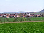
Castell-Rüdenhausen
Bavaria geography stubsCounties of the Holy Roman EmpireGerman history stubs
Castell-Rüdenhausen was a County in the region of Franconia in northern Bavaria of the Holy Roman Empire, ruled by a branch of the Counts of Castell. It was created as a partition of Castell and in 1806, it was mediatised to Bavaria. A branch of the Princely House is the famous noble Faber-Castell family.
Excerpt from the Wikipedia article Castell-Rüdenhausen (License: CC BY-SA 3.0, Authors).Castell-Rüdenhausen
Gartenstraße, Wiesentheid
Geographical coordinates (GPS) Address Nearby Places Show on map
Geographical coordinates (GPS)
| Latitude | Longitude |
|---|---|
| N 49.7665 ° | E 10.3395 ° |
Address
Gartenstraße
Gartenstraße
97355 Wiesentheid
Bavaria, Germany
Open on Google Maps
