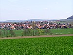
Castell-Castell
1668 establishments in the Holy Roman EmpireBavaria geography stubsCounties of the Holy Roman EmpireGerman history stubs

Castell-Castell was a county in the Holy Roman Empire, ruled by a branch of the Counts of Castell. It was established as a partition of Castell-Remlingen in 1668, and it was partitioned between itself and Castell in 1709. It annexed the County of Castell in 1772, and was mediatised to Bavaria in 1806.
Excerpt from the Wikipedia article Castell-Castell (License: CC BY-SA 3.0, Authors, Images).Castell-Castell
Im Unterdorf, Wiesentheid
Geographical coordinates (GPS) Address Nearby Places Show on map
Geographical coordinates (GPS)
| Latitude | Longitude |
|---|---|
| N 49.7416 ° | E 10.3499 ° |
Address
Im Unterdorf
Im Unterdorf
97355 Wiesentheid
Bavaria, Germany
Open on Google Maps

