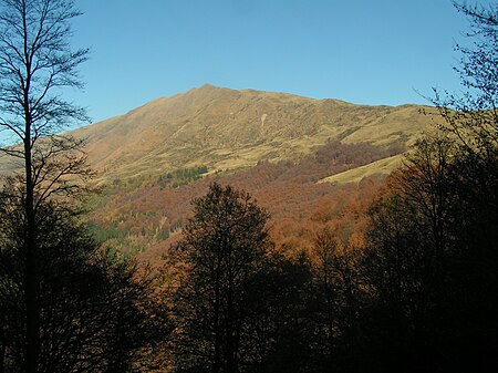
Gazzirola
International mountains of EuropeItaly–Switzerland borderLombardy mountain stubsLugano PrealpsMountains of Lombardy ... and 7 more
Mountains of SwitzerlandMountains of TicinoMountains of the AlpsProvince of Como geography stubsTicino mountain stubsTwo-thousanders of ItalyTwo-thousanders of Switzerland

The Gazzirola (also known as Garzirola) is a mountain of the Lugano Prealps on the Swiss-Italian border. Its summit is the highest point of the municipality of Lugano.
Excerpt from the Wikipedia article Gazzirola (License: CC BY-SA 3.0, Authors, Images).Gazzirola
alpe tabano - rifugio garzirola,
Geographical coordinates (GPS) Address Nearby Places Show on map
Geographical coordinates (GPS)
| Latitude | Longitude |
|---|---|
| N 46.118055555556 ° | E 9.0725 ° |
Address
Gazzirola
alpe tabano - rifugio garzirola
22010
Lombardy, Italy
Open on Google Maps


