place

Barcombe

BarcombeCivil parishes in East SussexLewes DistrictOpenDomesdayUse British English from July 2018
Villages in East Sussex
Barcombe Church
Barcombe Church

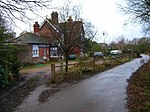
Barcombe is an East Sussex village and civil parish in the Lewes District of East Sussex. The parish has four settlements: old Barcombe (TQ 418 143), the oldest settlement in the parish with the parish church; Barcombe Cross (TQ 420 158), the more populous settlement and main hub with the amenities and services; the hamlet of Spithurst (TQ 426 174) in the north east and Town Littleworth (TQ 410 180) in the north west. Barcombe was recorded in the Domesday Book as "Berchamp". The origins of the place name 'Barcombe' may have derived from two sources: the Saxon 'Berecampe', meaning 'barley land' and the Latin loan word 'campus', a field.Barcombe is particularly noted to Sussex residents and tourists for 'Barcombe Mills', a reference to an old water-mill complex on the River Ouse at the base of the hill/plateau on which Barcombe Cross sits. The mills burnt down before the Second World War, but Barcombe Mills is still a popular Sunday outing for townsfolk from Lewes and Brighton.

Excerpt from the Wikipedia article Barcombe (License: CC BY-SA 3.0, Authors, Images).

Geographical coordinates (GPS)

Latitude Longitude
N 50.923 ° E 0.018 °
placeShow on map

Address


BN8 5BB , Barcombe
England, United Kingdom
mapOpen on Google Maps

Barcombe Church
Barcombe Church
Share experience

Nearby Places

Barcombe railway station

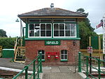
Barcombe was a railway station serving the village of Barcombe in East Sussex. It was part of the East Grinstead to Lewes line, part of which now makes up the Bluebell Railway. The station was originally opened as "New Barcombe" to distinguish it from the nearby station of Barcombe Mills (then called 'Barcombe') and was changed to its more usual name on 1 January 1885. In 1897 goods sidings were installed at a cost of £1450.It was planned to close the line and the station on 13 June 1955, although they actually closed on 29 May due to a railway strike. The line closure was found to be illegal under the original acts authorising construction of the railway and British Railways were forced to reopen it in August 1956. However, the station was not reopened as it was not mentioned in the legislation. After Parliament repealed the sections in question, the line was closed in March 1958 under the British Railways Branch-Line Report (prior to the Beeching Axe) and the track was lifted in 1960 from south of Sheffield Park to Culver Junction. Subsequently, Barcombe station building was sold and was converted into a private house. The platform edge is still visible but the trackbed has been infilled up to about one foot below platform level. Despite the re-opening of part of the East Grinstead-Lewes line by the Bluebell Railway, an extension south from its headquarters at Sheffield Park seems improbable in the short term as the intermediate station, Newick and Chailey is now covered by housing, and several overbridges would have to be rebuilt.

Barcombe Mills
Barcombe Mills

Barcombe Mills is a small settlement and an area of countryside including a local nature reserve near the village of Barcombe Cross in East Sussex, England. It is located in the civil parish of Barcombe in the Lewes District. It is an important area for its wildlife, natural environment and water storage. The River Ouse and Andrew's Stream, one of its tributaries and popular for fishing, flow through the area and Barcombe Reservoir is adjacent. The area includes a small hamlet and some farms, including Barcombe House, and a water treatment works. There were mills in the parish of Barcombe as far back as the 11th century. Thomas and Denise Erith are recorded as holding a corn mill at the beginning of the 16th century. Although the original mills were destroyed by fire in 1939, several pillboxes from the Second World War, a beautiful large brick bridge and many weirs remain. The old road through the Mills features a former toll bridge which still displays its tolls in pre-decimalisation currency and a plaque mentioning that it was featured in the Domesday Book commissioned by William I. The local pub is the Anchor Inn, where canoes can be hired for trips down the Ouse. This public house, however, is situated about a kilometre to the north of the main hamlet and cannot be accessed directly by road from Barcombe Mills. It can be accessed along the disused trackbed of the railway or by walking over footpaths. It can also be reached by car by driving into the village of Barcombe Cross and turning right; it is then signposted down the dead-end Anchor Lane. The pub's address is in Barcombe Mills but it is generally considered as an offshoot of Barcombe Cross or Spithurst. The disused Barcombe Mills railway station served the village until 1969. Now just a collection of houses and a water treatment works, the area once had a thriving community. A pub called the Anglers' Rest (formerly known as the Railway Inn) closed in the 1990s. This was situated next to the former railway station. A restaurant was also present in the former railway station and this closed soon after the pub. Many more houses were also present at one time when the oil mills and the button factory still existed on the banks of the Ouse. The tributaries, weirs and millstreams cut to feed this are still obvious today - this is why the river takes such a bizarre course at Barcombe Mills. The hamlet is signposted from the village of Barcombe Cross but from nowhere else. In early 2018 two village signs were erected along Barcombe Mills Road, one at either side of the hamlet. Since it has lost many of its services it has reduced to a quiet backwater consisting of houses, farms and the Bob Davis Scout Hut which is used by the 1st Barcombe Scout Group in the summer months.

Offham Hill

Offham Hill is a causewayed enclosure, near Lewes in East Sussex. Causewayed enclosures were built in England from shortly before 3700 BC until about 3300 BC; they are characterized by the full or partial enclosure of an area with ditches that are interrupted by gaps, or causeways. Their purpose is not known; they may have been settlements, meeting places, or ritual sites. The site was first identified as a possible causewayed enclosure in 1964, by a member of the Sussex Archaeological Society. The Ordnance Survey inspected the site in 1972 and recommended an exvacation, which was carried out in 1976 by Peter Drewett. The site was badly damaged by ploughing by the time of Drewett's excavation, which limited his ability to draw conclusions from finds in the ploughsoil. Drewett mapped what appeared to be ditches, banks, and causeways before beginning to dig, and then cleared about half the site down to the chalk, confirming the location of the ditches and causeways. The majority of Drewett's finds came from the ditches, including about 7,000 worked flints, nearly 300 sherds of pottery, a human burial, and other finds including more human bone and some animal remains. Most of the pottery was identified as Neolithic, and radiocarbon dating of some charcoal found in one of the ditches confirmed that the enclosure dated to the Neolithic. A reanalysis of the radiocarbon dates in 2011, along with further radiocarbon dates from the human remains, concluded that the enclosure was constructed in the mid-fourth millennium BC. The site was listed as a scheduled monument in 1954.