place

Offham Marshes

Sites of Special Scientific Interest in East Sussex
Track to Landport geograph.org.uk 1099297

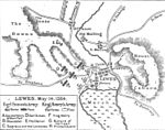
Offham Marshes, also known as The Pells and Offham Marsh, is a 39.1-hectare (97-acre) biological Site of Special Scientific Interest on the northern outskirts of Lewes in East Sussex in parish of Hamsey. It includes the Pellbrook Cut, an area to the north of it called The Pells and the marshland to the south of the Cut and east of the railway track.

Excerpt from the Wikipedia article Offham Marshes (License: CC BY-SA 3.0, Authors, Images).

Offham Marshes
Landport Farm Road,

Geographical coordinates (GPS) Address Nearby Places
placeShow on map

Wikipedia: Offham MarshesContinue reading on Wikipedia

Geographical coordinates (GPS)

Latitude Longitude
N 50.888 ° E -0.005 °
placeShow on map

Address

Landport Farm Road

Landport Farm Road
BN7 2FP
England, United Kingdom
mapOpen on Google Maps

Track to Landport geograph.org.uk 1099297
Share experience

Nearby Places

Offham Hill

Offham Hill is a causewayed enclosure, near Lewes in East Sussex. Causewayed enclosures were built in England from shortly before 3700 BC until about 3300 BC; they are characterized by the full or partial enclosure of an area with ditches that are interrupted by gaps, or causeways. Their purpose is not known; they may have been settlements, meeting places, or ritual sites. The site was first identified as a possible causewayed enclosure in 1964, by a member of the Sussex Archaeological Society. The Ordnance Survey inspected the site in 1972 and recommended an exvacation, which was carried out in 1976 by Peter Drewett. The site was badly damaged by ploughing by the time of Drewett's excavation, which limited his ability to draw conclusions from finds in the ploughsoil. Drewett mapped what appeared to be ditches, banks, and causeways before beginning to dig, and then cleared about half the site down to the chalk, confirming the location of the ditches and causeways. The majority of Drewett's finds came from the ditches, including about 7,000 worked flints, nearly 300 sherds of pottery, a human burial, and other finds including more human bone and some animal remains. Most of the pottery was identified as Neolithic, and radiocarbon dating of some charcoal found in one of the ditches confirmed that the enclosure dated to the Neolithic. A reanalysis of the radiocarbon dates in 2011, along with further radiocarbon dates from the human remains, concluded that the enclosure was constructed in the mid-fourth millennium BC. The site was listed as a scheduled monument in 1954.