place

Crowmarsh Gifford

Former civil parishes in OxfordshirePopulated places on the River ThamesSouth Oxfordshire DistrictUse British English from August 2015Villages in Oxfordshire
Wallingford, Oxfordshire
St Mary Magdalene Church, Crowmarsh Gifford

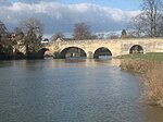
Crowmarsh Gifford, commonly known as Crowmarsh, is a village in the civil parish of Crowmarsh, in the South Oxfordshire district, in the county of Oxfordshire, England. It is beside the River Thames opposite the market town of Wallingford, the two linked by Wallingford Bridge. Crowmarsh parish also includes the hamlet of Newnham Murren, which is now merged with the village; the hamlet of Mongewell, and the village of North Stoke 2 miles (3.2 km) to the south.

Excerpt from the Wikipedia article Crowmarsh Gifford (License: CC BY-SA 3.0, Authors, Images).

Crowmarsh Gifford
Howbery Farm, South Oxfordshire Crowmarsh

Geographical coordinates (GPS) Address Nearby Places
placeShow on map

Wikipedia: Crowmarsh GiffordContinue reading on Wikipedia

Geographical coordinates (GPS)

Latitude Longitude
N 51.599 ° E -1.112 °
placeShow on map

Address

Howbery Farm

Howbery Farm
OX10 8ED South Oxfordshire, Crowmarsh
England, United Kingdom
mapOpen on Google Maps

St Mary Magdalene Church, Crowmarsh Gifford
Share experience

Nearby Places

Howbery Park
Howbery Park

Howbery Park is a 36-ha park located adjacent to the River Thames in Crowmarsh Gifford near Wallingford, UK. Its main feature is an English manor house built in about 1850 by Member of Parliament (MP) William Seymour Blackstone. Blackstone fell into debt, largely because of the building costs, which resulted in him spending time in the debtors' prison at Oxford and contributed to the end of his political career. He died in Brighton, never having lived at Howbery Park.Other owners of Howbery Park were Henry Bertie Williams-Wynn (who purchased the house in 1867), Harvey du Cros (in 1902) and George Denison Faber, 1st Baron Wittenham. The estate passed into the ownership of the government in the 1930s and was used during the Second World War to house US and Canadian servicemen and then refugees from Central Europe. After the war, it was selected as the location for the new Hydraulics Research Station (HRS), established under the directorship of Sir Claude Inglis. HRS was privatised in 1982 from the Department of the Environment (DoE) and the HR Wallingford Group was created. The new company was limited by guarantee, had no shareholders and was given the remit to invest in hydraulic research. The assets transferred with Howbery Park in 1982 included the grant-funded-state-of-the-art- Fountain Building, and a new mainframe computer. The Manor House and Stable Block are Listed Buildings Grade II (1985). In addition to HR Wallingford who occupy a new building, Kestrel House, several other organisations are now based in Howbery Park, including the Environment Agency. There are several stories of strange occurrences concerning Howbery Park. The most common one is the ghost of the Lady in Grey. Several drivers on Benson Lane, adjacent to Howbery Park, claim to have been forced to swerve to avoid a lady dressed in grey who was walking in the road. A lady in grey was seen to walk in the grounds of the French Gardens, now the site of the South Oxfordshire District Council. Local stories are that this is the ghost of Lady Wittenham, wife of George Denison Faber, 1st Baron Wittenham. In September 2007 key scenes for the feature-film adaptation of Philip Pullman's The Butterfly Tattoo (film) were shot on site.

A4074 road
A4074 road

The A4074 is a British A road from the Reading suburb of Caversham to the Heyford Hill roundabout on the Oxford Ring Road.The road starts from a junction with the A4155 close to the northern side of Caversham Bridge (over the River Thames) before climbing through the up-market residential area of Caversham Heights. Crossing the Reading Borough boundary, the road proceeds through the small community of Chazey Heath, where it enters thick woodland for several miles before emerging near the village of Woodcote. From here it crosses the more exposed ground of the Chiltern Hills before bypassing both Wallingford and Crowmarsh Gifford on the Wallingford bypass. It then passes by Benson, passes through Shillingford, bypasses Dorchester and passes through Nuneham Courtenay. The road becomes dual-carriageway as it passes Sandford-on-Thames and remains so to its terminus on the Oxford Ring Road at the Heyford Hill roundabout.The road was designated in the 1980s, when the B479 between Caversham and Crowmarsh Gifford was renumbered. In 1990 the A423 from Crowmarsh to Heyford Hill was renumbered the A4074, and the road became the primary route between Reading and Oxford in place of the A329 along the River Thames. The short stretch of the Oxford Ring Road between Heyford Hill and the Hinksey Hill interchange was not renumbered A4074, and remains an isolated fragment of the A423. The poor safety record of a particular stretch of this road, roughly between Chazey Heath and Woodcote, is highlighted in its local nickname, The 13 Bends of Death. Its accident rate of 53 per 100 million vehicle kilometres is nearly 70% higher than average for roads of its type.A half-hourly bus service, branded as river rapids and operated by Thames Travel, owned by Go-Ahead like its sister company the Oxford Bus Company, runs between Reading and Oxford along the A4074, albeit passing through the centre of Wallingford rather than using the by-pass. Alternate buses are numbered X39 and X40, with the X40 also diverting from the main road to serve Woodcote.