place

Lozells

Areas of Birmingham, West MidlandsConservation areas in EnglandWest Midlands (county) geography stubs
Art deco carving by William Bloye (doorway to the Royal Oak Public House, Lozells, Birmingham, England)

Lozells is a loosely defined inner-city area in West Birmingham, England. It is centred on Lozells Road, and is known for its multi-racial population. It is part of the ward of Lozells and East Handsworth and lies between the districts of Handsworth and Aston. Lozells has a high population density compared to East Handsworth. It is a very ethnically diverse area with a high population of people of Afro-Caribbean, Bangladeshi and Pakistani origin. Housing in Lozells consists mainly of terraced houses, which were constructed during the Industrial Revolution when the area became industrialised and the workers required housing. The housing is a mix of private and council housing, with some newer post-war tower-blocks and estates. Lozells Road was the scene of rioting from 9–11 September 1985, with shops, houses and vehicles being burnt, and looting also taking place. Racial tension, high unemployment and hostility towards the police were seen as major factors of the rioting. Further riots on the night of the 22 October 2005 left two men dead and a police officer shot and wounded. These riots were started by an unsubstantiated rumour, broadcast on a pirate radio station, of a girl being raped. Four men were later jailed for their part in the riots.The former Royal Oak pub on Lozells Road, now a shop, has a doorway with a carving of a 'royal oak' by the sculptor William Bloye.

Excerpt from the Wikipedia article Lozells (License: CC BY-SA 3.0, Authors, Images).

Lozells
Burbury Street, Birmingham

Geographical coordinates (GPS) Address Nearby Places
placeShow on map

Wikipedia: LozellsContinue reading on Wikipedia

Geographical coordinates (GPS)

Latitude Longitude
N 52.501515 ° E -1.909819 °
placeShow on map

Address

Burbury Street

Burbury Street
B19 1TR Birmingham
England, United Kingdom
mapOpen on Google Maps

Art deco carving by William Bloye (doorway to the Royal Oak Public House, Lozells, Birmingham, England)
Share experience

Nearby Places

Icknield Street School

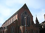
Icknield Street School (grid reference SP057882), near the Hockley Flyover, north of the Jewellery Quarter, Birmingham, England, is a good example of a Birmingham board school. It is owned by Birmingham City Council.Designed in 1883 by J.H. Chamberlain of Martin & Chamberlain, the main architects for the Birmingham School Board, it has been St Chad's Roman Catholic Annexe and is now an Ashram Centre. Standard VII classes for girls began in 1885. However, these classes closed in 1898 at the opening of the George Dixon Higher Grade Board School. In 1886, it was expanded and again so in 1894. It converted into a modern secondary school in 1945 and by 1960, it had 950 pupils. The Chamberlain schools were designed for hygiene, light, fresh air and beauty. Typically in red brick and terracotta, gabled, with steep roofs, free planning and towered to provide ventilation. The tower was typically placed over the staircase to draw air through the school. There were terracotta plaques, glazed tiles, ornamental ironwork, tall windows, and stained glass. The arched roof-supporting ironwork of this school was visible when the roof was missing following a fire. The roof has since been repaired. It is a Grade II* listed building. The headmaster's house (303 Icknield Street), on the site, is separately Grade II* listed. Both are on the English Heritage Heritage at Risk Register, and in December 2021, the pair were included on the Victorian Society's annual "Top Ten Endangered Buildings" list.