place

St Mary Aldermanbury

12th-century establishments in England1966 disestablishments in EnglandChristopher Wren church buildings in LondonChurches bombed by the Luftwaffe in LondonChurches rebuilt after the Great Fire of London but since demolished
English Baroque architectureGrade II listed churches in LondonParks and open spaces of the City of London CorporationRelocated buildings and structures in the United Kingdom
StMaryAldermanbury
StMaryAldermanbury

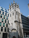
St Mary Aldermanbury was a parish church in the City of London first mentioned in 1181 and destroyed by the Great Fire of London in 1666. Rebuilt in Portland stone by Christopher Wren, it was again gutted by the Blitz in 1940, leaving only the walls standing. These stones were transported to Fulton, Missouri in 1966, by the residents of that town, and rebuilt in the grounds of Westminster College as a memorial to Winston Churchill. Churchill had made his Sinews of Peace, "Iron Curtain" speech in the Westminster College Gymnasium in 1946. The footprint of the church remains at the junction of London's Aldermanbury and Love Lane, planted with bushes and trees; a memorial plaque has been placed by Westminster College in the footprint. The gardens also house a monument to Henry Condell and John Heminges, key figures in the production of the First Folio of William Shakespeare's plays and co-partners with him in the Globe Theatre. Condell and Heminges lived in the St Mary Aldermanbury parish and were buried in its churchyard. This monument is topped with a bust of Shakespeare. The remains of the church were designated a Grade II listed building on 5 June 1972. The monuments are separately listed.In the 1830s, the notable missionary William Jowett was a lecturer at the church.

Excerpt from the Wikipedia article St Mary Aldermanbury (License: CC BY-SA 3.0, Authors, Images).

St Mary Aldermanbury
Aldermanbury, City of London

Geographical coordinates (GPS) Address External links Nearby Places
placeShow on map

Wikipedia: St Mary AldermanburyContinue reading on Wikipedia

Geographical coordinates (GPS)

Latitude Longitude
N 51.516483333333 ° E -0.093072222222222 °
placeShow on map

Address

St Mary Aldermanbury

Aldermanbury
EC2V 7RF City of London
England, United Kingdom
mapOpen on Google Maps

linkWikiData (Q7594557)
linkOpenStreetMap (164201035)

StMaryAldermanbury
StMaryAldermanbury
Share experience

Nearby Places

City of London
City of London

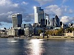
The City of London is a city, ceremonial county and local government district that contains the historic centre and constitutes, alongside Canary Wharf, the primary central business district (CBD) of London. It constituted most of London from its settlement by the Romans in the 1st century AD to the Middle Ages, but the modern area named London has since grown far beyond the City of London boundary. The City is now only a small part of the metropolis of Greater London, though it remains a notable part of central London. Administratively, the City of London is not one of the Greater London boroughs, a status reserved for the other 32 districts (including Greater London's only other city, the City of Westminster). It is also a separate ceremonial county, being an enclave surrounded by Greater London, and is the smallest ceremonial county in the United Kingdom. The City of London is widely referred to simply as the City (differentiated from the phrase "the city of London" by capitalising City) and known as the Square Mile, as it is 1.12 sq mi (716.80 acres; 2.90 km2) in area. Both of these terms are also often used as metonyms for the United Kingdom's trading and financial services industries, which continue a notable history of being largely based in the City. The name London is now ordinarily used for a far wider area than just the city. London most often denotes the sprawling London metropolis, or the 32 Greater London boroughs, in addition to the City of London itself. This wider usage of London is documented as far back as 1888, when the County of London was created.The local authority for the City, namely the City of London Corporation, is unique in the UK and has some unusual responsibilities for a local council, such as being the police authority. It is also unusual in having responsibilities and ownerships beyond its boundaries. The corporation is headed by the Lord Mayor of the City of London (an office separate from, and much older than, the Mayor of London). The Lord Mayor, as of November 2021, is Vincent Keaveny. The City is made up of 25 wards, with administration at the historic Guildhall. Other historic sites include St Paul's Cathedral, Royal Exchange, Mansion House, Old Bailey, and Smithfield Market. Although not within the City, the adjacent Tower of London is part of its old defensive perimeter. The City has responsibility for five bridges in its capacity as trustee of the Bridge House Estates: Blackfriars Bridge, Millennium Bridge, Southwark Bridge, London Bridge and Tower Bridge. The City is a major business and financial centre, and the Bank of England is headquartered in the city. Throughout the 19th century, the City was the world's primary business centre, and it continues to be a major meeting point for businesses. London came top in the Worldwide Centres of Commerce Index, published in 2008. The insurance industry is located in the eastern side of the city, around Lloyd's building. A secondary financial district exists outside the city, at Canary Wharf, 2.5 miles (4 km) to the east. The City has a resident population of 9,401 (ONS estimate, mid-2016) but over 500,000 are employed there, and some estimates put the number of workers in the City to be over 1 million. About three-quarters of the jobs in the City of London are in the financial, professional, and associated business services sectors. The legal profession forms a major component of the northern and western sides of the city, especially in the Temple and Chancery Lane areas where the Inns of Court are located, of which two—Inner Temple and Middle Temple—fall within the City of London boundary.

Wood Street, London
Wood Street, London

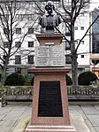
Wood Street is a street in the City of London, the historic centre and primary financial district of London. It originates in the south at a junction with Cheapside; heading north it crosses Gresham Street and London Wall. The northernmost end runs alongside The Postern, part of the Barbican estate, stopping at Andrewes House. Today Wood Street lies within the wards of Bassishaw (north of Gresham Street) and Cheap (south of Gresham Street). The street was originally the main north–south route through the Roman Fort, which was discovered after World War II bombing. The north gate of the fort became Cripplegate, the south gate of the fort was just south of the junction with Love Lane, and the road diverts slightly to the east suggesting that the gate was blocked up or in use, and they had to knock through the Roman fort wall to allow Wood Street to continue. It has been suggested that this was an early road after the so-called Alfredian restoration of the City in around 886 AD. The road led from the main port at Queenhithe (Bread Street) to the main market street at Cheapside and then on north to Cripplegate and out of London to the north. Wood Street is the location of the headquarters of the City of London Police, at its corner with Love Lane. There is a tower on a traffic island in the middle of the street, which is all that remains of the church of St Alban, Wood Street. Other notable buildings include 88 Wood Street, and the hall of the Worshipful Company of Pewterers on nearby Oat Lane.