place

High Street Historic District (Wilmington, Massachusetts)

Buildings and structures in Wilmington, MassachusettsHistoric districts in Middlesex County, MassachusettsHistoric districts on the National Register of Historic Places in MassachusettsMiddlesex County, Massachusetts Registered Historic Place stubsNRHP infobox with nocat
National Register of Historic Places in Middlesex County, MassachusettsUse mdy dates from August 2023
WilmingtonMA 24 26HighStreet

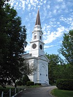
The High Street Historic District in Wilmington, Massachusetts is a residential historic district along High Street. The district runs east from High Street's junction with Salem Street (Massachusetts Route 62) to a sharp bend in the road where it meets the right-of-way for Interstate 93. Of the 17 contributing properties, all but four are located on the north side of the road (between numbers 8 and 72); the rest are on the south side (numbers 31, 47, 57 and 67). It represents a cluster of high quality houses built mainly in the second half of the 19th century, although there is one contributing property (a Cape style house at 58 High Street) built in 1942. The styling of these houses is diverse, with all of the popular revival styles of the period represented. Houses built in the 20th century are predominantly Colonial Revival or Craftsman/Bungalow in style.The district was listed on the National Register of Historic Places in 2003.

Excerpt from the Wikipedia article High Street Historic District (Wilmington, Massachusetts) (License: CC BY-SA 3.0, Authors, Images).

High Street Historic District (Wilmington, Massachusetts)
High Street,

Geographical coordinates (GPS) Address Nearby Places
placeShow on map

Wikipedia: High Street Historic District (Wilmington, Massachusetts)Continue reading on Wikipedia

Geographical coordinates (GPS)

Latitude Longitude
N 42.5725 ° E -71.153055555556 °
placeShow on map

Address

High Street 31
01887
Massachusetts, United States
mapOpen on Google Maps

WilmingtonMA 24 26HighStreet
Share experience

Nearby Places

Harnden Tavern
Harnden Tavern

The Harnden Tavern, also known as the Col. Joshua Harnden Tavern, is a historic tavern that was built in 1770 at 430 Salem Street in Wilmington, Massachusetts. The Col. Joshua Harnden Tavern was built during the last third of the eighteenth century in the town of Wilmington, Massachusetts. The site is on Lot No. One in the "Land of Nod," in the most northerly part of the Charlestown Grant. This imposing structure is an excellent surviving example of late-Georgian architecture. Joshua Harnden was the great-grandson of Richard Harnden, the first Englishman to settle in what is now North Wilmington. Joshua and his wife Sarah (Cornell) and their six children were the first family to occupy this house. During the Revolutionary War, Joshua served in Capt. Timothy Walker's Militia Co. Later he attained the rank of colonel shortly before his retirement. Joshua was elected to serve the Town of Wilmington as one of its three selectmen. After the Revolutionary War, he opened his home to the public as an inn or tavern. Col. Harnden died on September 9, 1807. His wife died on August 9, 1816. The property was sold to Dr. Silas Brown in 1818. It remained in the Brown - Hathaway family for 125 years. There is credible tradition that the tavern was used as a station on the Underground Railroad prior to the Civil War.The building was taken by the town by eminent domain in 1973, and presently houses the Wilmington Town Museum. The building was listed on the National Register of Historic Places in 1975.

Buck's Corner Historic District

Buck's Corner Historic District encompasses a cluster of formerly rural (now suburban) properties in eastern Wilmington, Massachusetts. The district covers 9.88 acres (4.00 ha), and includes six houses and three barns whose construction dates range from the late 17th to the late 19th centuries. Many of them have some association with the descendants of Roger Buck, who with his son Ephraim is said to have built the Ephraim Buck House (216 Wildwood Street) around the turn of the 18th century. Other houses in the district range along Woburn Street, south from Wildwood Street to Allenhurst Way. The district was listed on the National Register of Historic Places in 2003.The oldest portion of the Ephraim Buck House is believed to have been built c. 1704, with a second section added in the 1740s. Its exterior was restyled c. 1770 to give it Federal period styling, including a front door entry with 3/4 length sidelight windows and an entablature. The Daniel Eames House at 584 Woburn Street may also have been built by Ephraim Buck, c. 1714-23, and is a fairly typical early Georgian house. A third 18th century house, that at 604 Woburn Street, was originally believed to be 17th century in origin, but is more likely a Federal period construction from c. 1785-91.The Jonathan Buck House (571 Woburn Street, c. 1795-1820) is an excellent local example of Federal architecture, and one of only a few period hip roofed houses in the town. It is the typical five bays wide and two deep, with a central doorway flanked by full-length sidelight windows and pilasters supporting a narrow entablature. The remaining contributing houses to the district were built later in the 19th century: the Henry Sheldon House (603 Woburn Street, c. 1861-62) is Italianate in style, and the John Howard Eames House (590 Woburn Street, c. 1883) is a Queen Anne Victorian. Three houses have 19th century barns that contribute to the district (as did the Ephraim Buck House until its barn was demolished).Two houses within the district bounds do not contribute to its significance. One is a modern house (c. 1999) at 588 Woburn Street; the other, at 580 Woburn Street, was an Italianate house built c. 1856-75, but has been renovated in an historically insensitive manner. A Buck family house at 585 Woburn Street, dating to the late 18th century, was demolished not long before the district boundaries were drawn.