Fricktal

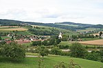
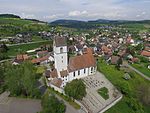
The Fricktal ("Frick Valley") is a region on Northwestern Switzerland, comprising the Laufenburg and Rheinfelden districts of the Swiss canton of Aargau. The region was known as Frickgau in the medieval period, ultimately from a Late Latin [regio] ferraricia, in reference to the iron mine located here in the Roman era, also transferred to the village of Frick as the main settlement.Frickgau was part of Breisgau within Further Austria in the early modern period. It was joined to Switzerland only during the Napoleonic period. It now forms a northwestern extension to the canton of Aargau to the east of Basel, between the High Rhine forming the border with Germany in the north and the Jura Mountains in the south.
Excerpt from the Wikipedia article Fricktal (License: CC BY-SA 3.0, Authors, Images).Fricktal
Bergstrasse, Böztal
Geographical coordinates (GPS) Address Nearby Places Show on map
Geographical coordinates (GPS)
| Latitude | Longitude |
|---|---|
| N 47.505952777778 ° | E 8.0521194444444 ° |
Address
Bergstrasse
5075 Böztal
Aargau, Switzerland
Open on Google Maps


