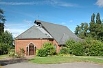
Temple Park
Berkshire geography stubsBracknellSuburbs in the United Kingdom
Temple Park is a suburb of Bracknell in the English county of Berkshire and part of the civil parish of Binfield. It was built during the 1990s as the town continued to expand on open countryside between Bracknell and Binfield. The estate lies approximately 1.1 miles (1.8 km) north-west of Bracknell town centre, to the north of the B3408 and to the west of Priestwood. Temple Park is built around Park Farm in Wood Lane, the Home Farm of the old Binfield Manor estate. The Blue Mountain Golf Club was located to the west of the estate [1].
Excerpt from the Wikipedia article Temple Park (License: CC BY-SA 3.0, Authors).Temple Park
Dunford Place,
Geographical coordinates (GPS) Address Nearby Places Show on map
Geographical coordinates (GPS)
| Latitude | Longitude |
|---|---|
| N 51.425622 ° | E -0.772931 ° |
Address
Dunford Place
Dunford Place
RG42 4UQ , Temple Park
England, United Kingdom
Open on Google Maps


