Quelm Park
Berkshire geography stubsBracknellPopulated places in BerkshireWarfield

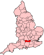
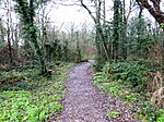
Quelm Park is a suburb of Bracknell, in Berkshire, England. The settlement lies west of the A3095 road, south of the Bracknell Northern Distributor Road "Harvest Ride" and is approximately 0.75 miles (1.21 km) north of Bracknell town centre. It takes its name from "Quelm Lane", an ancient thoroughfare that runs north–south through the development. "Quelm" is thought to mean "gibbet" and may be derived from the Old English cwelm, cwealm meaning 'death, murder, slaughter'.Quelm Park was built in the latter 1990s as a planned urban extension to Bracknell; however it lies entirely within the parish of Warfield, forming the Quelm Ward of Warfield Parish Council.
Excerpt from the Wikipedia article Quelm Park (License: CC BY-SA 3.0, Authors, Images).Quelm Park
Quelm Lane,
Geographical coordinates (GPS) Address Nearby Places Show on map
Geographical coordinates (GPS)
| Latitude | Longitude |
|---|---|
| N 51.42852 ° | E -0.7509 ° |
Address
Quelm Lane
Quelm Lane
RG42 2PZ
England, United Kingdom
Open on Google Maps


