Love Point, Maryland
Eastern Shore, Maryland geography stubsGeography of Queen Anne's County, MarylandKent Island, Maryland
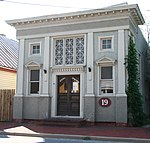
Love Point is the name for the northernmost tip of Kent Island, Maryland, United States and as such, marks the southern point of the mouth of the Chester River. It has served as a major ferry terminal, the western terminus of the Queen Anne's Railroad, and the nominal western terminus of Maryland Route 18 (which is aligned in a north–south direction near Love Point). Two notable landmarks once stood at the Love Point area; the Love Point Light and Hotel Love Point, both of which are destroyed. Today, Love Point is primarily a residential area.
Excerpt from the Wikipedia article Love Point, Maryland (License: CC BY-SA 3.0, Authors).Love Point, Maryland
Kemp Lane,
Geographical coordinates (GPS) Address Nearby Places Show on map
Geographical coordinates (GPS)
| Latitude | Longitude |
|---|---|
| N 39.031944444444 ° | E -76.311388888889 ° |
Address
Kemp Lane 122
21666
Maryland, United States
Open on Google Maps


