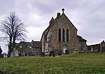
Claughton, Lancaster
Civil parishes in LancashireForest of BowlandGeography of the City of LancasterUse British English from March 2015Villages in Lancashire

Claughton ( KLAF-tən) is a small village and civil parish in the City of Lancaster in Lancashire, England. The village is on the A683 road east of Lancaster and at the time of the 2001 census had a population of 132. In the 2011 census Claughton was grouped with Roeburndale (2001 pop. 76) to give a total of 223.North of the village is the River Lune, and to the south is Claughton Moor and the fells of the Forest of Bowland.
Excerpt from the Wikipedia article Claughton, Lancaster (License: CC BY-SA 3.0, Authors, Images).Claughton, Lancaster
Lancaster Road, Lancaster
Geographical coordinates (GPS) Address Nearby Places Show on map
Geographical coordinates (GPS)
| Latitude | Longitude |
|---|---|
| N 54.094 ° | E -2.664 ° |
Address
Lancaster Road
Lancaster Road
LA2 9LD Lancaster
England, United Kingdom
Open on Google Maps


