place

Batu Ferringhi

Beaches of MalaysiaGeorge Town, PenangLandforms of PenangPopulated places in Penang
Batu Ferringhi street (221002)

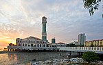
Batu Ferringhi is a suburb of George Town in Penang, Malaysia. Located along the northern coast of Penang Island and about 11 km (6.8 mi) northwest of the city centre, it is the prime beach destination in Penang among locals and tourists. To cater to the influx of tourists, several major high-rise hotels have been established along the 4 km (2.5 mi) stretch of beaches. The beach resorts along Batu Ferringhi also offer various water sport activities, such as parasailing. On a clear day, one could get a picturesque view of the Andaman Sea and Mount Jerai, which is located within the neighbouring state of Kedah. In addition, Batu Ferringhi is famous for its night market that offers a wide variety of merchandise and street food. There had been human activity within Batu Ferringhi as early as 1592, when an Englishman, Sir James Lancaster, arrived and began pillaging other vessels around Penang Island. However, for much of its recent history, Batu Ferringhi was a quiet village, until the urbanisation of the area beginning in the 1970s. Due to its location along the northern coast of Penang Island, Batu Ferringhi was hard hit by the 2004 Indian Ocean earthquake and tsunami.

Excerpt from the Wikipedia article Batu Ferringhi (License: CC BY-SA 3.0, Authors, Images).

Batu Ferringhi
Batu Ferringgi Road,

Geographical coordinates (GPS) Address Nearby Places
placeShow on map

Wikipedia: Batu FerringhiContinue reading on Wikipedia

Geographical coordinates (GPS)

Latitude Longitude
N 5.4683 ° E 100.242 °
placeShow on map

Address

Batu Ferringgi Road
11100 , Batu Feringgi
Penang, Malaysia
mapOpen on Google Maps

Batu Ferringhi street (221002)
Share experience

Nearby Places

Penang National Park

The Penang National Park (Malay: Taman Negara Pulau Pinang; تامن نݢارا ڤولاو ڤينڠ; Chinese: 槟城国家公园; Bīnchéng guójiā gōngyuán; Tamil: பினாங்கு தேசியப் பூங்காக்கள்; Piṉāṅku tēciyap pūṅkākkaḷ) spans 1,213ha of land and sea and is used by scientists, researchers, and nature lovers to explore its natural treasures. Previously known as the Pantai Acheh Forest Reserve, this pristine site is known to harbour 417 flora and 143 fauna species. Pantai Acheh Forest Reserve, located at the northwestern tip of Penang Island, was declared the Penang National Park in April 2003. Penang National Park is the first protected area legally gazetted under Malaysia's National Park Act of 1980, signifying the State and Federal governments' environmental protection efforts. Penang National Park was established to preserve and protect flora and fauna as well as objects with geological, archaeological, historical, ethnological, scientific, and scenic interests. Natural attractions of Pulau Pinang National Park include the hill / lowland dipterocarp forests, mangrove forest areas, sandy beach habitats, a seasonal meromictic lake and the open coastal seas. Stands of seraya (Shorea curtisii) trees, common feature of coastal dipterocarp forest, can be easily seen on steep slopes around Muka Head. There are over 1000 species of plants recorded which are dominated by the families Dipterocarpaceae, Leguminosae, Apocynaceae, Anacardiaceae, Euphorbiaceae and Moraceae. Part of the Pantai Acheh Forest Reserve had been logged before 1955; no forest areas there have been logged since 1955. All logging activities were stopped in 1996, and Malaysian public funding has been allocated to develop the Penang National Park, within guidelines.