place

Washington Crossing Historic Park

American Revolutionary War museums in PennsylvaniaAmerican Revolutionary War sitesGeorge Washington's crossing of the Delaware RiverHistory museums in PennsylvaniaHistory of Bucks County, Pennsylvania
Museums in Bucks County, PennsylvaniaNational Register of Historic Places in Bucks County, PennsylvaniaOpen-air museums in PennsylvaniaParks in Bucks County, PennsylvaniaParks on the National Register of Historic Places in PennsylvaniaState parks of PennsylvaniaUse mdy dates from August 2023
Washington Crossing Park Visitor Center

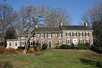
Washington Crossing Historic Park is a 500-acre (2 km2) state park operated by the Pennsylvania Department of Conservation and Natural Resources in partnership with the Friends of Washington Crossing Park. The park is divided into two sections. One section of the park, the "lower park," is headquartered in the village of Washington Crossing located in Upper Makefield Township in Bucks County, Pennsylvania. It marks the location of George Washington's crossing of the Delaware River during the American Revolutionary War. The lower park includes 13 historic buildings including McConkey's Ferry Inn, where General George Washington and his aides ate dinner and made plans prior to the crossing. Among the historic buildings is a 20th-century barn that houses 5 replica Durham Boats. Durham boats were large, open boats that were used to transport pig iron along the Delaware River at the time of the Revolution and these boats, along with the ferries and others, were used to transport soldiers, horses, and equipment across the river on the night of December 25–26, 1776. The replica boats are used each year when the nighttime crossing is reenacted in the park. Located 4.5 miles away in Solebury Township, Bucks County, Pennsylvania, is the park's northern section, the "upper park." In its 100-acre area it contains (0.4 km2) Bowman's Hill Tower and the Thompson-Neely House, which was used as a military hospital during Washington's encampment in the area, and the graves of an estimated 40 to 60 soldiers who died there. The exact location of the graves is unknown, though they were partially unearthed during the construction of the nearby Delaware Canal in the early 19th century and during other nearby construction projects. Presently there are 23 memorial headstones as a reminder that the area is a gravesite. The lower park contains a visitor's center, which was renovated from July 2011 to March 2013. The newly renovated visitor's center was opened March 10, 2013. It features a small exhibition with some Revolutionary war artifacts, and an original letter written by George Washington while in the McConkey's Ferry Inn. The park also has obtained a full size digital copy of Emanuel Leutze's 1851 painting, Washington Crossing the Delaware, from the Metropolitan Museum of Art, that is hanging in the auditorium.

Excerpt from the Wikipedia article Washington Crossing Historic Park (License: CC BY-SA 3.0, Authors, Images).

Washington Crossing Historic Park
River Road,

Geographical coordinates (GPS) Address Nearby Places
placeShow on map

Wikipedia: Washington Crossing Historic ParkContinue reading on Wikipedia

Geographical coordinates (GPS)

Latitude Longitude
N 40.2975 ° E -74.876388888889 °
placeShow on map

Address

River Road

River Road
18977
Pennsylvania, United States
mapOpen on Google Maps

Washington Crossing Park Visitor Center
Share experience

Nearby Places

George Washington's crossing of the Delaware River

George Washington's crossing of the Delaware River, which occurred on the night of December 25–26, 1776 during the American Revolutionary War, was the first move in a surprise attack organized by General George Washington, the commander-in-chief of the Continental Army, against Hessian forces garrisoned at Trenton, who were German mercenaries hired by the British. After crossing the Delaware River, Washington and his troops successfully attacked the Hessian forces in the Battle of Trenton on the morning of December 26, 1776. The military campaign was organized in great secrecy by Washington, who led a column of Continental Army troops from today's Bucks County, Pennsylvania across the icy Delaware River to today's Mercer County, New Jersey in what was one of the Revolutionary War's most logistically challenging and dangerous clandestine operations. Other planned crossings in support of the operation were either called off or ineffective, but this did not prevent Washington from surprising and defeating the Hessian troops under Johann Rall. After prevailing in the Battle of Trenton, Washington and his Continental Army troops crossed the Delaware River again, returning to Pennsylvania with prisoners and military stores taken in the battle. Washington's army then crossed the river a third time at the end of 1776 under conditions made more difficult by the uncertain thickness of the ice on the river. They defeated British reinforcements under Lord Cornwallis at Trenton on January 2, 1777, and were also triumphant over his rear guard at Princeton the next day before retreating to winter quarters in Morristown, New Jersey. As a celebrated early turn in the ultimately victorious Revolutionary War, the unincorporated communities of Washington Crossing, Pennsylvania and Washington Crossing, New Jersey are both presently named in honor of Washington and the event.

Jacobs Creek (New Jersey)

Jacobs Creek is a tributary of the Delaware River in Mercer County in the U.S. state of New Jersey. From its headwaters in Hopewell Township, the creek flows generally south and southwest. Along the creek's lower course, it flows along the border between Hopewell Township and Ewing Township, entering the Delaware River between Lambertville and Trenton.Arising along the west flank of Pennington Mountain, elevation 381 feet (116 m), Jacobs Creek flows under Poor Farm Road, through Woosamonsa Ridge Preserve and under Woosamonsa Road before reaching Pennington-Harbourton Road (County Route 623). Further downstream, it passes under Pennington-Titusville Road and then Washington Crossing-Pennington Road (CR 546). After receiving Woolsey Brook from the left, Jacobs Creek flows roughly parallel to Jacobs Creek Road (CR 637), which is on the left bank, and passes under Bear Farm Road (CR 579). The creek turns southwest as it reaches the boundary between Hopewell Township and Ewing Township and follows this boundary, crossing it several times before passing under River Road (New Jersey Route 29), the Delaware and Raritan Canal and its towpath and entering the Delaware River.Jacobs Creek Trail, runs 1.3 miles (2.1 km) along the creek between Pennington-Harbourton Road on the north (upstream end) and Pennington-Titusville Road on the south with an additional 0.25 miles (0.40 km) spur south of Pennington-Titusville Road. The trail environs include a mixture of bottomlands, bluffs, and open spaces. Deer, fox, amphibians, and reptiles frequent the area. Birds near the trail and creek may include Carolina wrens, woodpeckers, red-eyed vireos and Baltimore orioles. Evergreens, eastern redcedars, maples, hickories, ashes, and oaks grow along the main trail. The largest red oak in the Hopewell Valley is found in the preserve.