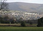
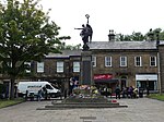
Glossop is a market town in the borough of High Peak, in the county of Derbyshire, England. It is located 15 miles (24 km) east of Manchester, 24 miles (39 km) north-west of Sheffield and 32 miles (51 km) north of the county town, Matlock. Glossop lies near Derbyshire's borders with Cheshire, Greater Manchester, South Yorkshire and West Yorkshire. It is between 150 and 300 metres (492 and 984 ft) above sea level and is bounded by the Peak District National Park to the south, east and north. In 2021 it had a population of 33,340.
Historically, the name Glossop refers to the small hamlet that gave its name to an ancient parish recorded in the Domesday Book of 1086 and then the manor given by William I of England to William Peverel. A municipal borough was created in 1866, which encompassed less than half of the manor's territory. The area now known as Glossop approximates to the villages that used to be called Glossopdale, on the lands of the Duke of Norfolk. Originally a centre of wool processing, Glossop rapidly expanded in the late 18th century when it specialised in the production and printing of calico, a coarse cotton. It became a mill town with many chapels and churches; its fortunes were tied to the cotton industry.
Architecturally, the area is dominated by buildings constructed with the local sandstone; a number of these, including Glossop Gasworks, are grade II listed. Two significant former cotton mills and the Dinting railway viaduct remain.


