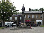
Whitfield, Derbyshire
GlossopHamlets in DerbyshireTowns and villages of the Peak District

Whitfield is a hamlet and former parish in Derbyshire, England. It is half a mile (1km) south of Glossop Town Hall, south of Glossop Brook between Bray Clough and Hurst Brook. Whitfield was one of the original townships in the ancient Parish of Glossop. Up to the latter part of the 18th century the hamlet was devoted mostly to agriculture with an area of 2,608 statute acres. The area rises from about 169m to about 266m above mean sea level.
Excerpt from the Wikipedia article Whitfield, Derbyshire (License: CC BY-SA 3.0, Authors, Images).Whitfield, Derbyshire
Sefton Street, High Peak Whitfield
Geographical coordinates (GPS) Address Nearby Places Show on map
Geographical coordinates (GPS)
| Latitude | Longitude |
|---|---|
| N 53.441 ° | E -1.952 ° |
Address
Sefton Street
Sefton Street
SK13 8HZ High Peak, Whitfield
England, United Kingdom
Open on Google Maps


