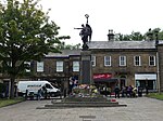
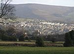
Municipal Borough of Glossop
Derbyshire geography stubsDistricts of England abolished by the Local Government Act 1972History of DerbyshireMunicipal boroughs of EnglandUnited Kingdom government stubs

Glossop was a Municipal Borough in Derbyshire, England from 1866 to 1974. It was created under the Municipal Corporations Act 1835. It was enlarged in 1934 when part of the civil parish of Charlesworth was incorporated into the borough.The borough was abolished in 1974 under the Local Government Act 1972 and combined with the Municipal Borough of Buxton, the urban districts of New Mills and Whaley Bridge and the rural districts of Chapel en le Frith and Tintwistle to form the new High Peak district.
Excerpt from the Wikipedia article Municipal Borough of Glossop (License: CC BY-SA 3.0, Authors, Images).Municipal Borough of Glossop
Victoria Street, High Peak Whitfield
Geographical coordinates (GPS) Address Phone number Website Nearby Places Show on map
Geographical coordinates (GPS)
| Latitude | Longitude |
|---|---|
| N 53.443 ° | E -1.949 ° |
Address
The Mixologist
Victoria Street 7
SK13 8HY High Peak, Whitfield
England, United Kingdom
Open on Google Maps


