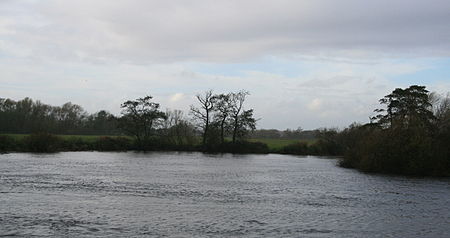
Derwent Mouth

Derwent Mouth is a location on the River Trent, which at that point forms the border between the English counties of Derbyshire and Leicestershire. It is both the confluence of the River Derwent with the River Trent, and the point at which the Trent and Mersey Canal joins the natural River Trent. Derwent Mouth is situated closest to Sawley, Derbyshire and is 1 mile (1.6 km) to the east of Shardlow, 2 miles (3.2 km) west of Trent Lock, where the navigable River Soar and Erewash Canal join the River Trent. It is about 9 miles (14 km) south-west of the centre of the city of Nottingham, and 7 miles (11 km) south-east of central Derby. The River Trent is navigable, with the aid of locks, downstream of Derwent Mouth as far as the Humber Estuary. The Trent itself is also navigable for a short distance upstream, but most river traffic enters the parallel Trent and Mersey Canal, which provides connections to the River Mersey and the canal networks of the West Midlands region. The River Derwent is not navigable.
Excerpt from the Wikipedia article Derwent Mouth (License: CC BY-SA 3.0, Authors, Images).Derwent Mouth
Long Horse Bridge, South Derbyshire Shardlow and Great Wilne
Geographical coordinates (GPS) Address Nearby Places Show on map
Geographical coordinates (GPS)
| Latitude | Longitude |
|---|---|
| N 52.8725 ° | E -1.3193 ° |
Address
Long Horse Bridge
Long Horse Bridge
DE72 2HP South Derbyshire, Shardlow and Great Wilne
England, United Kingdom
Open on Google Maps


