place

Rømø

Danish Wadden Sea IslandsGeography of Tønder MunicipalityIslands of DenmarkRømø
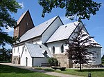
Rømø kirke
Rømø kirke

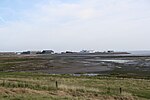
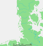
Rømø (German: Röm, North Frisian: Rem) is a Danish island in the Wadden Sea. Rømø is part of Tønder Municipality. The island had 650 inhabitants as of 1 January 2011, and covers an area of 129 km². Rømø is the southernmost of Denmark's Wadden Sea Islands. This distinction was previously held by the small uninhabited island of Jordsand, which sank in 1999.

Excerpt from the Wikipedia article Rømø (License: CC BY-SA 3.0, Authors, Images).

Rømø
Småfolksvej, Tønder Municipality

Geographical coordinates (GPS) Address Nearby Places
placeShow on map

Wikipedia: RømøContinue reading on Wikipedia

Geographical coordinates (GPS)

Latitude Longitude
N 55.133333333333 ° E 8.5166666666667 °
placeShow on map

Address

Småfolksvej

Småfolksvej
6792 Tønder Municipality
Region of Southern Denmark, Denmark
mapOpen on Google Maps

Rømø kirke
Rømø kirke
Share experience

Nearby Places

Jordsand
Jordsand

Jordsand (North Frisian: Jorsund) was a small Danish hallig located in the Wadden Sea southeast of the Danish island Rømø and east of the German island Sylt. The island was first known by the name Hiortsand ("hart island") and was possibly connected to both the mainland and the island of Sylt. The old name refers to the presence of deer on the island. Records from 1231 describe the island as having a size equivalent of 20 km2 (7.7 square miles). It contained numerous terps. The island was destroyed in a series of storm tides. Its size was described in 1807 and 1873 as 40.7 and 18.4 hectares respectively. In 1895, a storm destroyed the last terp and the island was abandoned and became a bird sanctuary. Attempts to protect it from the recurring floods were made in the 1970s but with limited success since the island remained unprotected by a dyke. The island's size ultimately shrunk to 2.3 hectares and the uninhabited island was finally destroyed in a flood during the winter of 1998/99. By 1999 all vegetation on the former island had disappeared, and the Danish Nature Agency removed its observational hut from the flooded area. In 1999, the island was officially registered as disappeared.The area is now a sandbank (højsande), Jordsand Flak similar to Koresand near Fanø. Højsande denotes a sandbank that is only flooded during exceptionally high waters. Its name lives on in the name of one of Germany's oldest environmental organizations, Verein Jordsand established in 1907.

Kongeå
Kongeå

The Kongeå (in German Königs Au) is a watercourse in Southern Jutland in Jutland, Denmark. It rises southeast of Vejen and Vamdrup and after about 50 kilometres (31 mi) it flows through a sluice to tidal mudflats and sandbanks north of Ribe, and eventually into the North Sea. The eastern section is little more than a stream, while the western section is navigable by boat as far as the sluice. The Kongeå, however, passes no port or market town of any significance, and small boats use the Ribe Å. Historically, the watercourse has been the administrative border between regions to the north and south. In the Middle Ages it was called Skodborg Å after the royal castle Skodborghus, where a track crossed the watercourse south of Vejen. For centuries a customs border near the Kongeå separated the Kingdom of Denmark from the duchy of Schleswig. From 1864 to 1920, except in the extreme west, the Kongeåen marked the border between Denmark and Germany.The Kongeå is mentioned (as "Skotborg river") in the Heimskringla in a description of the 1043 battle in which King Magnus I of Norway and Denmark defeated at Lyrskov Hede (Hlyrskog Heath) a large army of Slavs who had invaded southern Denmark from the current Mecklenburg region in retaliation for a Viking attack on Jomsborg, which at the time was the Slavic kingdom's primary town on Wolin island. The area around the river is the site of several preserved burial mounds that have been the subject of archeological study, including Skelhøj.