place

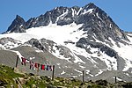
Chüealphorn

Alpine three-thousandersDavosGraubünden mountain stubsMountains of GraubündenMountains of Switzerland
Mountains of the AlpsS-chanf
Chüealphorn 2020
Chüealphorn 2020

The Chüealphorn is a mountain of the Albula Alps, overlooking the Scaletta Pass, in Graubünden, Switzerland.

Excerpt from the Wikipedia article Chüealphorn (License: CC BY-SA 3.0, Authors, Images).

Geographical coordinates (GPS)

Latitude Longitude
N 46.685333333333 ° E 9.9053888888889 °
placeShow on map

Address

Davos


Grisons, Switzerland
mapOpen on Google Maps

Website
gemeindedavos.ch

linkVisit website

Chüealphorn 2020
Chüealphorn 2020
Share experience

Nearby Places

Flüela Pass
Flüela Pass

The Flüela Pass (German: Flüelapass, Romansh: Pass dal Flüela, elevation 2,384 m (7,822 ft)) is a high mountain pass of the Swiss Alps in Graubünden. Traditionally considered the boundary between the Albula and Silvretta Alps, the pass crosses the watershed / drainage divide between the basins of the rivers Rhine and Danube. The pass is overlooked by the Flüela Schwarzhorn (Albula Alps) and the Flüela Wisshorn (Silvretta Alps). The summit of the pass lies between the lakes Lai da la Scotta and Lai Nair.The Flüela Pass is one of the three paved road passes connecting the Engadin with the northern Grisons, the two other being the Julier Pass and the Albula Pass.The Flüela Pass is traversed by a paved road. The latter road connects Davos (central Graubünden) with Susch (Engadin). On the summit of the pass is the Flüela Hospice. Since 1999, the range can be traversed by rail as well, although at a drastically lower elevation, through the Vereina Tunnel. The line, operated by the Rhaetian Railway, connects Klosters with Susch and Lavin and runs about 5-7 kilometres northeast of the Flüela road, parallel to it. Car shuttle trains are also operated on the line. As a result, the pass road is no longer guaranteed to be open all year. An NGO, Pro Flüela Verein, was established in 1990 to extend the opening outside the summer months. It raises money from membership fees, and grants from the cantonal government and local communes.
Albula Alps
Albula Alps

The Albula Alps are a mountain range in the Alps of eastern Switzerland. They are considered to be part of the Central Eastern Alps, more specifically the Western Rhaetian Alps. They are named after the river Albula. According to AVE (see map), the Albula Alps are separated from the Oberhalbstein Alps in the west by the Septimer Pass and the valley of the Sursés; from the Plessur Alps in the north-west by the Landwasser valley; from the Silvretta group in the north-east by the Flüela Pass; from the Sesvenna Alps in the east by the Inn valley (Engadine); from the Livigno Alps in the south-east by the Inn valley; from the Bernina Range in the south by the Maloja Pass and the Inn valley. The chief summit of the Albula Alps is Piz Kesch, which is also the highest summit of the Eastern Alps north of the Inn. Other mountains with both a high elevation and a high prominence are Piz Calderas, Piz Ela, Piz Ot and Piz Vadret. The Albula Alps are drained by the rivers Albula, Gelgia, Landwasser and Inn and Mera. Near the Lunghin Pass is the tripoint between the Gelgia, Inn and Mera. This is the tripoint between the basins of the North Sea, Black Sea and Mediterranean Sea. The main road passes crossing the Albula Alps (from central Graubünden to Engadin) are the Julier Pass and the Albula Pass. On the margin are also the Flüela Pass and the Septimer Pass (bridle path only). The Albula Pass, in the middle of the range, is also an important axis of the Rhaetian Railway, connecting Chur to St. Moritz through the Albula Tunnel. Both pass road and railway traverse the locality of Bergün on the river Albula, the most central town within the Albula Alps.