Southmead
Areas of BristolEngvarB from October 2013SouthmeadWards of Bristol

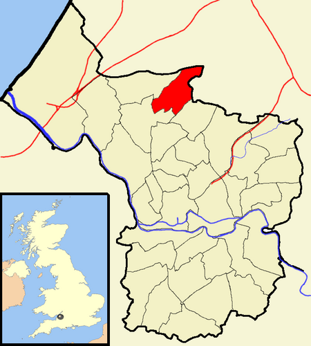
Southmead is a northern suburb and council ward of Bristol, in the south west of England, bordered by Filton in South Gloucestershire and Monks Park, Horfield, Henleaze and Westbury on Trym. The River Trym rises in Southmead and flows south west through Badock's Wood, a Local Nature Reserve. There is a round barrow near the northern end of the wood, and a Site of Special Scientific Interest, Pen Park Hole.
Excerpt from the Wikipedia article Southmead (License: CC BY-SA 3.0, Authors, Images).Southmead
Ullswater Road, Bristol Southmead
Geographical coordinates (GPS) Address Nearby Places Show on map
Geographical coordinates (GPS)
| Latitude | Longitude |
|---|---|
| N 51.5039 ° | E -2.6028 ° |
Address
Ullswater Road
Ullswater Road
BS10 6ED Bristol, Southmead
England, United Kingdom
Open on Google Maps


