Pen Park Hole
Caves of BristolSouthmead

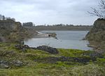
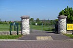
Pen Park Hole is a large cavern situated underground, at the edge of Filton Golf Course. The cavern was discovered accidentally in the 17th century and the first descent was made by Captain Sturmy in 1669. The entrance is adjacent to the Southmead and Brentry housing estates of north Bristol. Access is tightly controlled by Bristol City Council. It was scheduled as a Site of Special Scientific Interest in 2016 on account of its geological origins, and its cave invertebrate community including the cave shrimp Niphargus kochianus, which is normally known as a spring seepage or chalk aquifer species.
Excerpt from the Wikipedia article Pen Park Hole (License: CC BY-SA 3.0, Authors, Images).Pen Park Hole
Chetwode Close, Bristol Brentry
Geographical coordinates (GPS) Address Nearby Places Show on map
Geographical coordinates (GPS)
| Latitude | Longitude |
|---|---|
| N 51.510421 ° | E -2.598882 ° |
Address
Chetwode Close 10
BS10 6JF Bristol, Brentry
England, United Kingdom
Open on Google Maps


