Rodenkirchen
Boroughs and quarters of CologneCologne region geography stubsRodenkirchen

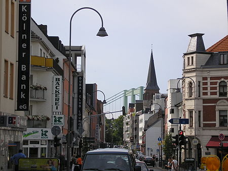
Rodenkirchen (German: Köln-Rodenkirchen) is a southern borough (Stadtbezirk) of Cologne (Köln) in Germany. It has about 110,000 inhabitants and covers an area of 54.55 square kilometres (21.06 square miles). The borough includes the quarters Bayenthal, Godorf, Hahnwald, Immendorf, Marienburg, Meschenich, Raderberg, Raderthal, Rodenkirchen, Sürth, Rondorf, Weiß and Zollstock. The 1000-year-old quarter Rodenkirchen, situated close to the Rhine, today represents the center of the borough. It has more than 16,000 inhabitants.
Excerpt from the Wikipedia article Rodenkirchen (License: CC BY-SA 3.0, Authors, Images).Rodenkirchen
Maternusstraße, Cologne Rodenkirchen (Rodenkirchen)
Geographical coordinates (GPS) Address Nearby Places Show on map
Geographical coordinates (GPS)
| Latitude | Longitude |
|---|---|
| N 50.891388888889 ° | E 6.9911111111111 ° |
Address
Maternusstraße 37
50996 Cologne, Rodenkirchen (Rodenkirchen)
North Rhine-Westphalia, Germany
Open on Google Maps


