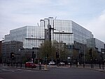
Cumberland Basin (London)
Canal basins in England and WalesFormer buildings and structures in the London Borough of CamdenLondon docksRegent's CanalTransport in the London Borough of Camden ... and 2 more
United Kingdom canal stubsUse British English from January 2018

Cumberland Basin (or Cumberland Market Basin) was a canal basin near to Euston railway station in London, England and a part of the Regent's Canal. It was originally known as Jew's Harp Basin in the 1880s, after a nearby public house. The basin's excavation was authorised in 1813 to serve Cumberland Market and then-industrial "New Road" and in 1941-1942 was filled back in chiefly using rubble from the London Blitz of those years and the previous year.
Excerpt from the Wikipedia article Cumberland Basin (London) (License: CC BY-SA 3.0, Authors, Images).Cumberland Basin (London)
Augustus Street, London Fitzrovia (London Borough of Camden)
Geographical coordinates (GPS) Address Nearby Places Show on map
Geographical coordinates (GPS)
| Latitude | Longitude |
|---|---|
| N 51.5302 ° | E -0.1425 ° |
Address
Augustus Street
NW1 3SY London, Fitzrovia (London Borough of Camden)
England, United Kingdom
Open on Google Maps


