Beit Sira
Municipalities of the State of PalestineRamallah and al-Bireh GovernorateVillages in the West Bank

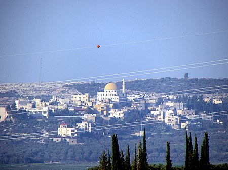
Beit Sira (Arabic: بيت سيرا) is a Palestinian village in the central West Bank, located 22 kilometers west of Ramallah and is a part of the Ramallah and al-Bireh Governorate. The village is situated along the Green Line. During the 1948 Arab-Israeli War, around 4,000 dunams of its land became a part of the "No-Man's Land" strip between the north-central West Bank and Israel. Currently Beit Sira's jurisdiction is 3,120 dunams, of which 441 dunams are built-up areas and the remainder is open spaces for future construction or agricultural land.
Excerpt from the Wikipedia article Beit Sira (License: CC BY-SA 3.0, Authors, Images).Beit Sira
Bait Siera,
Geographical coordinates (GPS) Address Nearby Places Show on map
Geographical coordinates (GPS)
| Latitude | Longitude |
|---|---|
| N 31.8875 ° | E 35.044166666667 ° |
Address
Bait Siera
Bait Siera
051
Palestinian Territories
Open on Google Maps


