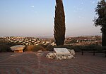
Kfar Ruth
1977 establishments in AsiaHevel Modi'in Regional CouncilIsraeli settlementsMoshavimPopulated places established in 1977 ... and 1 more
Populated places in Central District (Israel)

Kfar Ruth (Hebrew: כְּפַר רוּת, lit. 'Ruth's Village') is an Israeli settlement organised as a moshav. It was established in 1977 in an area that had become a no-man's land between Israel and Jordanian-controlled West Bank at the end of the 1948 Arab–Israeli War, before becoming part of the Israeli-occupied territories in the 1967 Six-Day War. It falls under the jurisdiction of Hevel Modi'in Regional Council and had a population of 284 in 2021.
Excerpt from the Wikipedia article Kfar Ruth (License: CC BY-SA 3.0, Authors, Images).Kfar Ruth
Hevel Modiin Regional Council
Geographical coordinates (GPS) Address Nearby Places Show on map
Geographical coordinates (GPS)
| Latitude | Longitude |
|---|---|
| N 31.91 ° | E 35.035555555556 ° |
Address
7170593 Hevel Modiin Regional Council
Center District, Israel
Open on Google Maps


