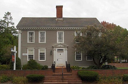
Simsbury Center Historic District
Colonial architecture in ConnecticutHistoric districts in Hartford County, ConnecticutHistoric districts on the National Register of Historic Places in ConnecticutNRHP infobox with nocatNational Register of Historic Places in Hartford County, Connecticut ... and 3 more
Simsbury, ConnecticutUse mdy dates from August 2023Victorian architecture in Connecticut

The Simsbury Center Historic District is a 75-acre (30 ha) historic district located in the town center area of Simsbury, Connecticut. It encompasses seven blocks of Hopmeadow Street, as well as the cluster of commercial, civic, and residential buildings along Railroad, Station, and Wilcox Streets, and Phelps Lane. Although its oldest element is the cemetery (established 1688), most of its buildings were built in the late 19th and early 20th century. It was listed on the National Register of Historic Places in 1996.: 2
Excerpt from the Wikipedia article Simsbury Center Historic District (License: CC BY-SA 3.0, Authors, Images).Simsbury Center Historic District
Plank Hill Road,
Geographical coordinates (GPS) Address External links Nearby Places Show on map
Geographical coordinates (GPS)
| Latitude | Longitude |
|---|---|
| N 41.875277777778 ° | E -72.803055555556 ° |
Address
Simsbury Center Historic District
Plank Hill Road
06070
Connecticut, United States
Open on Google Maps


