Cap de la Hague

Cap de la Hague is a cape at the tip of the Cotentin peninsula in Normandy, France. The La Hague area has precambrian granite and gneiss cliffs, several coves and small fields surrounded by hedges. France's oldest rocks are to be found on its coast in Jobourg. Other rocky outcroppings on the coast include Cadomian granite in Auderville and Variscan granite in Flamanville.The La Hague cape consists of two promontories about half a mile apart. The cape itself, which has the lighthouse and a lifeboat station, is very low-lying. The dialect of the Norman language spoken by a minority in the region is called Haguais. The Norman poet Côtis-Capel was a native of the region and used the landscape as inspiration for his poetry. The painter Jean-François Millet was also a native of the region. The La Hague site, the largest light water reactor nuclear waste reprocessing plant on earth (over half of the world's capacity), is located in the region.
Excerpt from the Wikipedia article Cap de la Hague (License: CC BY-SA 3.0, Authors, Images).Cap de la Hague
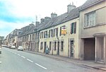
Rue des Écoliers, La Hague
Geographical coordinates (GPS) Address Phone number Nearby Places Show on map
Geographical coordinates (GPS)
| Latitude | Longitude |
|---|---|
| N 49.666666666667 ° | E -1.8333333333333 ° |
Address
Ehpad Roland Ricordeau
Rue des Écoliers
50440 La Hague
Normandy, France
Open on Google Maps


