place

Beekkant metro station

1981 establishments in BelgiumBelgian railway station stubsBrussels Metro stubsBrussels metro stationsMolenbeek-Saint-Jean
Railway stations opened in 1981
MetroBrussel Beekkant

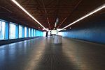
Beekkant is a Brussels metro station located in the municipality of Molenbeek-Saint-Jean, in the western part of Brussels (Belgium). It opened on 8 May 1981 as part of the Sainte-Catherine/Sint-Katelijne–Beekkant extension of former line 1, and was for a year, until 6 October 1982, the western terminus of the metro. Following the reorganisation of the Brussels metro on 4 April 2009, it is served by lines 1, 2, 5 and 6. The metro station runs parallel to a railway used for freight trains, and from 2010 again, as a suburban railway line of the future Brussels Regional Express Network (RER/GEN).

Excerpt from the Wikipedia article Beekkant metro station (License: CC BY-SA 3.0, Authors, Images).

Beekkant metro station
Rue Dubois-Thorn - Dubois-Thornstraat,

Geographical coordinates (GPS) Address External links Nearby Places
placeShow on map

Wikipedia: Beekkant metro stationContinue reading on Wikipedia

Geographical coordinates (GPS)

Latitude Longitude
N 50.853611111111 ° E 4.3227777777778 °
placeShow on map

Address

Beekkant

Rue Dubois-Thorn - Dubois-Thornstraat
1080
Belgium
mapOpen on Google Maps

linkWikiData (Q2893679)
linkOpenStreetMap (143725254)

MetroBrussel Beekkant
Share experience

Nearby Places

Molenbeek-Saint-Jean

Molenbeek-Saint-Jean (French, pronounced [molənbeːk sɛ̃ ʒɑ̃]) or Sint-Jans-Molenbeek (Dutch, pronounced [sɪɲˈcɑns ˈmoːlə(m)ˌbeːk] (listen)), often simply called Molenbeek, is one of the 19 municipalities of the Brussels-Capital Region, Belgium. Located in the western part of the region, it is bordered by the City of Brussels, from which it is separated by the Brussels–Charleroi Canal, as well as by the municipalities of Anderlecht, Berchem-Sainte-Agathe, Dilbeek, Jette and Koekelberg. The Molenbeek brook, from which it takes its name, flows through the municipality. In common with all of Brussels' municipalities, it is legally bilingual (French–Dutch). From its origins in the Middle Ages until the 18th century, Molenbeek was a rural village on the edge of Brussels, but around the turn of the 19th century, it experienced major growth brought on by a boom in commerce and manufacturing during the Industrial Revolution. Its prosperity declined after the Second World War, owing to deindustrialisation, leading to extensive investment and regeneration. Knowing a strong movement of immigration, mainly Moroccan, from the 1950s and 1960s, Molenbeek became increasingly multicultural with a minority Muslim population. In the early 21st century, it gained international attention as the base of Islamist terrorists who carried out attacks in both Paris and Brussels. Nowadays, it is a mostly residential municipality consisting of several historically and architecturally distinct districts.As of 1 January 2020, the municipality had a population of 97,979 inhabitants. The total area is 5.89 km2 (2.27 sq mi), which gives a population density of 16,314/km2 (42,250/sq mi), twice the average of Brussels. Its upper area is greener and less densely populated.

Simonis and Elisabeth stations

Simonis and Elisabeth are two interconnected stations on the Brussels Metro serving line 2 and line 6 on two different levels. Additionally Simonis is a railway station operated by NMBS/SNCB and a tram stop. The station complex is situated at the end of Boulevard Léopold II and is close to the Basilica of the Sacred Heart. Simonis was named after Place Eugène Simonis/Eugène Simonisplein, which in turn is named after the Belgian sculptor Eugène Simonis; while the nearby Elisabeth Park, named after Elisabeth of Bavaria, Queen of Belgium, gives Elisabeth its name. Simonis metro station opened on 6 October 1982 and is a through station in north–south direction situated in a cutting next to a railway line. It is served as a through station on line 6 and is a terminus of line 2. Elisabeth metro station is orthogonal to and one level below Simonis and is a terminal station located at the end of Boulevard Léopold II in east–west direction. It opened on 2 October 1988 and is the terminus for lines 2 and 6. Between its opening in 1988 and 2013, Elisabeth was also known as Simonis. Until 2009, Simonis was a simple interchange station between metro lines 1A and 2. When the Brussels metro loop opened in 2009, the north-western part of metro line 1A was connected to the other end of metro line 2, making line 2 an imperfect circle line (since a true circular train service is not possible, as the tracks at Simonis/Elisabeth are not connected). This resulted in the current situation, whereby the station complex is served twice by lines 2 and 6.To differentiate between the two station parts, the north–south through platforms were given the name Simonis (Leopold II), while the east–west terminating platforms were known as Simonis (Elisabeth). However, this did not improve the clarity of passenger information and thus, on 3 November 2013, Simonis (Leopold II) was reverted to simply Simonis, while Simonis (Elisabeth) became Elisabeth. The adjacent bus, tram and railway stops have not been renamed, and are all still known as Simonis. To the west of the stations, trams 9 and 19 call at underground platforms opened on 23 June 1986 (line 19) and 1 September 2018 (line 9), respectively. To the east of and parallel to Simonis metro station, the National Railway Company of Belgium operates a local commuter station Simonis since December 2009. It is served by the Brussels Regional Express Network service S10 between Dendermonde, Brussels, Denderleeuw and Aalst.