place

Castle Law

Archaeological sites in MidlothianHill forts in ScotlandHills of the Scottish Midland ValleyHistoric Environment Scotland propertiesLothians geography stubs
Mountains and hills of MidlothianScheduled Ancient Monuments in Midlothian
Castlelaw Hill Fort
Castlelaw Hill Fort

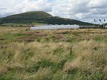
Castle Law is a hill south west of Fairmilehead in the Pentland Hills in Midlothian, Scotland. It is best known for the Iron Age hill fort on its slopes.

Excerpt from the Wikipedia article Castle Law (License: CC BY-SA 3.0, Authors, Images).

Castle Law
Glencorse View Walk,

Geographical coordinates (GPS) Address Nearby Places
placeShow on map

Wikipedia: Castle LawContinue reading on Wikipedia

Geographical coordinates (GPS)

Latitude Longitude
N 55.861838888889 ° E -3.2334361111111 °
placeShow on map

Address

Castlelaw Fort

Glencorse View Walk
EH26 0PR
Scotland, United Kingdom
mapOpen on Google Maps

Castlelaw Hill Fort
Castlelaw Hill Fort
Share experience

Nearby Places

Glencorse Reservoir
Glencorse Reservoir

Glencorse Reservoir is a reservoir in Midlothian, Scotland, two miles west of Glencorse, in the Pentland Hills. It is retained by an earth dam, and it was built between 1820 and 1824 by James Jardine to provide water for the mills of Auchendinny, Milton Bridge and Glencorse, and to supply drinking water to the citizens of Edinburgh. The dam is 23.5 metres (77 ft) at its highest point, one of the tallest in Britain when it was constructed, and was built at a point where a spur of rock narrowed the channel of the Glencorse Burn, which caused great difficulties in its construction. The gravel bed on which the burn flowed was up to 16.2 metres (53 ft) deep and when this was removed to create a clay-puddle dyke, the hill on the south side collapsed. The reservoir is the property of Scottish Water.The reservoir was built to provide water to compensate the mills at Glencorse, Milton Bridge and Auchendinny and to ensure a supply of drinking water to Edinburgh through a cast-iron pipe which took water to two small reservoirs in the city, at Castlehill and near George Heriot's School. The reservoir has an area of 19.3 hectares (48 acres).A Water Treatment Works was opened at Glencorse in 2012 to replace aged facilities at Alnwickhill and Fairmilehead and treat water from Talla, Fruid and Megget reservoirs. In 2019, Glencorse Water Treatment Works was reported to have the capacity to supply up to 175 million litres of water per day and was supplying water to up to 450,000 customers in parts of West Lothian and Edinburgh.Beneath the surface of the reservoir are the remains of St Catherine's of the Hopes, a 13th century chapel.

Glencorse

Glencorse is a parish of Midlothian, Scotland, lying 7 miles (11 kilometres) south of Edinburgh. It is bounded on the north-west by the former parish of Colinton now within the City of Edinburgh, to the north and west by Lasswade and to the south and west by Penicuik. The parish is in the northern part of the Penicuik and District Community Council area and includes the village of Auchendinny near its eastern boundary.The parish is traversed from west to east by Glencorse Burn, part of whose valley contains Glencorse Reservoir, which was formed in 1819-28 by damming the burn's glen with a huge embankment 40 m (130 ft) high. The reservoir is a source of Edinburgh's water supply. Also in the parish are Glencorse Barracks, Bush House, Glencorse House, Woodhouselee and Easter Howgate. The northern part of the parish includes some of the Pentland Hills and the highest point within the parish is Turnhouse Hill (428 m or 1,403 ft).Historical records of the Parish before 1878 spell it in various different ways - Glencors, Glencrosss, Glencrosse and Glencorse. After 1878 the last was normally used. There are several theories about the origin of the name Glencorse. One is that it comes form the Gaelic gleann - a glen and grosg or craig, a crossing - so a glen crossing the Pentland hills. George Chalmers in his book "Caledonia" claims the name comes from "a very remarkable cross, which has been erected in the vale of Glencross by pious hands." Yet another theory is that the name comes from a miraculous cross that appeared above Carnethy hill and encouraged the Scottish soldiers to defeat the English forces at the Battle of Roslin in 1303.The parish is divided between two Scottish Parliamentary constituencies: Midlothian North and Musselburgh to the north of Glencorse burn and Midlothian South, Tweeddale and Lauderdale south of the burn.