Plattenberg
Alpine three-thousandersGraubünden mountain stubsGraubünden–Ticino borderLepontine AlpsMountains of Graubünden ... and 4 more
Mountains of SwitzerlandMountains of TicinoMountains of the AlpsTicino mountain stubs

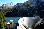
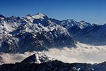
The Plattenberg is a mountain of the Lepontine Alps, located on the border between the Swiss cantons of Ticino and Graubünden. It lies approximately halfway between the lakes of Luzzone and Zervreila.
Excerpt from the Wikipedia article Plattenberg (License: CC BY-SA 3.0, Authors, Images).Plattenberg
Geographical coordinates (GPS) Address Website Nearby Places Show on map
Geographical coordinates (GPS)
| Latitude | Longitude |
|---|---|
| N 46.558305555556 ° | E 9.0234166666667 ° |
Address
Vals
7132
Grisons, Switzerland
Open on Google Maps


