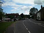
Ramsnest Common
Borough of WaverleyHamlets in Surrey

Ramsnest Common is a hamlet in the far south of the Borough of Waverley, the largest district of Surrey, England centred on the A283 1.5 miles (2.4 km) SSW of Chiddingfold village centre between Milford and Petworth in West Sussex which it borders. The area of overwhelmingly rural land, most of which is scattered forest, in particular Killinghurst Great Copse, had no medieval settlement.
Excerpt from the Wikipedia article Ramsnest Common (License: CC BY-SA 3.0, Authors, Images).Ramsnest Common
Killinghurst Lane, Waverley
Geographical coordinates (GPS) Address Nearby Places Show on map
Geographical coordinates (GPS)
| Latitude | Longitude |
|---|---|
| N 51.093 ° | E -0.652 ° |
Address
Killinghurst Lane
Killinghurst Lane
GU27 2EH Waverley
England, United Kingdom
Open on Google Maps


