Dewar, Iowa
1888 establishments in IowaNortheast Iowa geography stubsUnincorporated communities in Black Hawk County, IowaUnincorporated communities in IowaUse mdy dates from July 2023
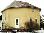
Dewar is an unincorporated town in eastern Black Hawk County, Iowa, United States. It lies northeast of the city of Waterloo, the county seat of Black Hawk County. Its elevation is 889 feet (271 m). Although Dewar is unincorporated, it has a post office with the ZIP code of 50623, which opened on 25 October 1887.
Excerpt from the Wikipedia article Dewar, Iowa (License: CC BY-SA 3.0, Authors).Dewar, Iowa
North Raymond Road,
Geographical coordinates (GPS) Address Nearby Places Show on map
 Continue reading on Wikipedia
 Geographical coordinates (GPS)
| Latitude | Longitude |
|---|---|
| N 42.525555555556 ° | E -92.219166666667 ° |
Address
Dewar Post Office
North Raymond Road
50623
Iowa, United States
Open on Google Maps