place

Garswood

Towns and villages in the Metropolitan Borough of St Helens
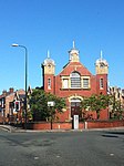
The Railway pub, Garswood

Garswood is a village in the Metropolitan Borough of St. Helens, Merseyside, England. The village is within the civil parish of Seneley Green. The parish was historically part of Ashton-in-Makerfield until 1974 boundary changes.

Excerpt from the Wikipedia article Garswood (License: CC BY-SA 3.0, Authors, Images).

Garswood
Strange Road,

Geographical coordinates (GPS) Address Nearby Places
placeShow on map

Wikipedia: GarswoodContinue reading on Wikipedia

Geographical coordinates (GPS)

Latitude Longitude
N 53.488 ° E -2.67 °
placeShow on map

Address

Strange Road

Strange Road
WN4 0RX , Seneley Green
England, United Kingdom
mapOpen on Google Maps

The Railway pub, Garswood
Share experience

Nearby Places

Billinge and Winstanley Urban District

Billinge (from 1927 Billinge and Winstanley) was, from 1872 to 1974, a local government district in the administrative county of Lancashire, England. The district was created in 1872 as a local government district, governed by a local board. It covered three separate parishes: Billinge Chapel End, Billinge Higher End and Winstanley. These had all previously been townships within the larger parish of Wigan, but as they appointed their own overseers of the poor they had each become separate civil parishes in 1866 with the passing of the Poor Law Amendment Act 1866. When sanitary districts were established in August 1872 the three parishes were briefly included in the Wigan Rural Sanitary District. A public meeting was held at the Stork Inn at Billinge Chapel End on 24 October 1872 where it was decided that the three parishes would form a group called the Billinge Local Government District, allowing them to establish their own board and become a separate urban sanitary district, independent of the Wigan Rural Sanitary District. The Local Government Board confirmed the creation of the district on 16 December 1872.Under the Local Government Act 1894, local boards became urban districts with effect from 31 December 1894. The 1894 Act also created parish councils for rural parishes, but the three parishes in the Billinge district were all classed as urban parishes and so did not have their own parish councils, being instead directly administered by Billinge Urban District Council. The three parishes were merged into a single parish called Billinge and Winstanley on 1 April 1924, covering the same area as the urban district, although the former parish areas continued to be used as wards for the election of councillors. The urban district was renamed Billinge and Winstanley on 5 May 1927.The urban district was abolished in 1974 by the Local Government Act 1972. It was one of only eleven urban districts or boroughs in England to be split between new districts under the 1972 Act. The Billinge Chapel End ward became a parish again, and was included in the Metropolitan Borough of St Helens in Merseyside. The rest of the urban district, covering Billing Higher End and Winstanley wards, became an unparished area in the Metropolitan Borough of Wigan in Greater Manchester.

Haydock
Haydock

Haydock is a village within the Metropolitan Borough of St Helens, in Merseyside, England. At the 2011 Census, it had a population of 11,416 Haydock's historic area covers the Haydock electoral ward and a section of the Blackbrook ward.Haydock is located within the boundaries of the historic county of Lancashire. The village is located to the north-east of the adjacent St Helens, with most of its residential estates and commercial property built either side of the A599. Historically a township and large pastoral area, Haydock was found to be rich with coal and the area grew in significance during the Industrial Revolution particularly with the coming of the canals and railways. In the 1930s, the north side of Haydock was bisected by the A580 East Lancashire Road; this dual carriageway connected the cities of Liverpool and Manchester, with several junctions serving St Helens and Haydock. The area to the south of the East Lancs road saw large post-war residential development, while the area to the north that was initially open pits and saw large scale industrialisation. More recently, the area north of the road has seen the development of distribution centres encouraged by the proximity of junction 23 of the M6 motorway and Haydock's convenient transport links to Liverpool and Manchester. Haydock is the home of the Haydock Park Racecourse, while the old mining tip and spoil areas south of the village have been developed into the Lyme & Wood Pits Country Park.