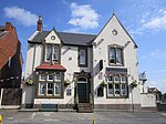
Haydock

Haydock is a village within the Metropolitan Borough of St Helens, in Merseyside, England. At the 2011 Census, it had a population of 11,416 Haydock's historic area covers the Haydock electoral ward and a section of the Blackbrook ward.Haydock is located within the boundaries of the historic county of Lancashire. The village is located to the north-east of the adjacent St Helens, with most of its residential estates and commercial property built either side of the A599. Historically a township and large pastoral area, Haydock was found to be rich with coal and the area grew in significance during the Industrial Revolution particularly with the coming of the canals and railways. In the 1930s, the north side of Haydock was bisected by the A580 East Lancashire Road; this dual carriageway connected the cities of Liverpool and Manchester, with several junctions serving St Helens and Haydock. The area to the south of the East Lancs road saw large post-war residential development, while the area to the north that was initially open pits and saw large scale industrialisation. More recently, the area north of the road has seen the development of distribution centres encouraged by the proximity of junction 23 of the M6 motorway and Haydock's convenient transport links to Liverpool and Manchester. Haydock is the home of the Haydock Park Racecourse, while the old mining tip and spoil areas south of the village have been developed into the Lyme & Wood Pits Country Park.
Excerpt from the Wikipedia article Haydock (License: CC BY-SA 3.0, Authors, Images).Haydock
Church Road,
Geographical coordinates (GPS) Address Nearby Places Show on map
Geographical coordinates (GPS)
| Latitude | Longitude |
|---|---|
| N 53.4678 ° | E -2.6609 ° |
Address
Church Road
Church Road
WA11 0TP
England, United Kingdom
Open on Google Maps


