Fiddler's Elbow
Islands of OxfordshireIslands of the River ThamesOxfordshire geography stubsUse British English from December 2016Vale of White Horse
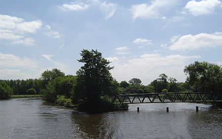
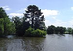
Fiddler's Elbow is the largest of a set of islands in the River Thames in England alongside and upstream of Sandford Lock, near Kennington, Oxfordshire. Fiddler's Elbow Island is in the shape of a leg of lamb with a wide expanse tapering upstream to a narrow point. The navigation channel passes to the east of the island and the main weir stream, leading to the Sandford Lasher (weir pool) passes to the west. Two smaller weir streams across the lower end of the island create two additional smaller islands. The island is entirely given over to open space and meadowland.
Excerpt from the Wikipedia article Fiddler's Elbow (License: CC BY-SA 3.0, Authors, Images).Fiddler's Elbow
Church Road, South Oxfordshire Sandford-on-Thames
Geographical coordinates (GPS) Address Nearby Places Show on map
Geographical coordinates (GPS)
| Latitude | Longitude |
|---|---|
| N 51.7125 ° | E -1.2355 ° |
Address
Sandford Lasher Memorial
Church Road
OX4 4XZ South Oxfordshire, Sandford-on-Thames
England, United Kingdom
Open on Google Maps

