place

Rue d'Alésia

Paris road stubsStreets in the 14th arrondissement of Paris

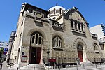
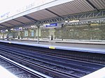
Rue d'Alésia is a major street in the south of Paris, which runs along the entire east-west length of the 14th arrondissement. It is one of the few streets in Paris named after a French defeat, or more precisely, a Gallic defeat: the Battle of Alesia. Lined with acacia trees, the street extends to the east as Rue de Tolbiac into the 13th arrondissement, and to the west as Rue de Vouillé into the 15th arrondissement. It intersects Avenue du Général Leclerc at the Place Victor et Hélène Basch (or simply Alésia), the location of the Église Saint Pierre de Montrouge, as well as of the Alésia Métro station.

Excerpt from the Wikipedia article Rue d'Alésia (License: CC BY-SA 3.0, Authors).

Rue d'Alésia
Rue d'Alésia, Paris Quartier du Parc-de-Montsouris (Paris)

Geographical coordinates (GPS) Address Nearby Places
placeShow on map

Wikipedia: Rue d'AlésiaContinue reading on Wikipedia

Geographical coordinates (GPS)

Latitude Longitude
N 48.8275 ° E 2.3344444444444 °
placeShow on map

Address

Cordonnerie et clés minute

Rue d'Alésia
75014 Paris, Quartier du Parc-de-Montsouris (Paris)
Ile-de-France, France
mapOpen on Google Maps

Share experience

Nearby Places

Denfert-Rochereau station

Gare de Denfert-Rochereau is a railway station in Paris. It was one of the first stations of the French railway network, and is still in use as a station of Paris' RER line B. The station was built from 1842 and opened on 7 June 1846 as the Gare d'Enfer (or Gare de Paris-d'Enfer), after the nearby Place d'Enfer (now called the Place Denfert-Rochereau), itself named after the Barrière d'Enfer. The station building had a circular shape as it possessed a rail loop. Indeed, the station was the Parisian terminus of a line from Sceaux. The Ligne de Sceaux used the Arnoux system (after its inventor), as it required the construction of specific engines capable of travelling on very tight curves and broad gauge tracks of 1,750 mm (5 ft 8+7⁄8 in). The Arnoux system was abandoned in 1891 and the line was converted to 1,435 mm (4 ft 8+1⁄2 in) (standard) gauge. The line was extended to Luxembourg station in 1895, with the newly created Port-Royal station along the way. At the same time, the station was renamed after Pierre Philippe Denfert-Rochereau. The line was operated by the Chemin de Fer de Paris à Orléans until 1937 when the Compagnie du Chemin de Fer Métropolitain de Paris (CMP) (predecessor of the RATP) took over. It became line B of the RER in 1977 on being extended to meet line A at Châtelet – Les Halles. The station building of Denfert-Rochereau station is the oldest railway building still standing in Paris. Denfert-Rochereau remains a station of line B of the Réseau Express Régional and is an interchange with the métro station of the same name, Denfert-Rochereau.