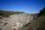
Bayeux (river)
France river stubsProvence-Alpes-Côte d'Azur geography stubsRivers of Bouches-du-RhôneRivers of FranceRivers of Provence-Alpes-Côte d'Azur ... and 1 more
Tributaries of the Étang de Berre

The Bayeux (Baion in Occitan) is a short stream in the southeast of France. In the upper 2 kilometres (1.2 mi) of its course it is called Bayon. It runs from the Montagne Sainte-Victoire to the Arc, near Meyreuil. It is 10 km (6.2 mi) long.
Excerpt from the Wikipedia article Bayeux (river) (License: CC BY-SA 3.0, Authors, Images).Bayeux (river)
Route de la Côte d'Azur, Aix-en-Provence
Geographical coordinates (GPS) Address Nearby Places Show on map
Geographical coordinates (GPS)
| Latitude | Longitude |
|---|---|
| N 43.500833333333 ° | E 5.5163888888889 ° |
Address
Route de la Côte d'Azur
Route de la Côte d'Azur
13590 Aix-en-Provence
Provence-Alpes-Côte d'Azur, France
Open on Google Maps


