Thornhill (federal electoral district)

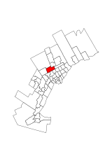
Thornhill is a federal electoral district in Ontario, Canada, that has been represented in the House of Commons of Canada since 1997. It covers its namesake Thornhill neighbourhood, which is split between the Cities of Vaughan and Markham. The Vaughan portion also includes parts of the city east of Highway 400 and south of Rutherford Road, including the largely industrial district of Concord and Vaughan's planned downtown; Vaughan Metropolitan Centre. The part in the City of Markham is restricted its portion of Thornhill itself (but does not include it all) west of Bayview Avenue. The riding was created in 1996 and the east end of the riding was split off into other ridings in 2012. The riding was initially safe for the Liberals, and they won large majorities of the vote in its first two elections. In 2004, the large Jewish population started shifting toward the Conservative Party, and the Conservatives won the riding in 2008. After being targeted by the Conservatives as part of their strategy to win a majority in 2011, the riding became a Conservative stronghold.
Excerpt from the Wikipedia article Thornhill (federal electoral district) (License: CC BY-SA 3.0, Authors, Images).Thornhill (federal electoral district)
Yonge Street, Vaughan Thornhill
Geographical coordinates (GPS) Address Phone number Website Nearby Places Show on map
Geographical coordinates (GPS)
| Latitude | Longitude |
|---|---|
| N 43.8112 ° | E -79.4236 ° |
Address
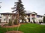
Thornhill Public School
Yonge Street 7554
L4J 1V8 Vaughan, Thornhill
Ontario, Canada
Open on Google Maps


