Newark-on-Trent

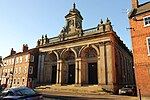
Newark-on-Trent () or Newark is a market town and civil parish in the Newark and Sherwood district in Nottinghamshire, England. It is on the River Trent, and was historically a major inland port. The A1 road bypasses the town on the line of the ancient Great North Road. The town's origins are likely to be Roman, as it lies on a major Roman road, the Fosse Way. It grew up round Newark Castle, St Mary Magdalene church and later developed as a centre for the wool and cloth trades. In the English Civil War, it was besieged by Parliamentary forces and relieved by Royalist forces under Prince Rupert. Newark has a market place lined with many historical buildings and one of its most notable landmarks is St Mary Magdalene church with its towering spire at 232 feet (71 metres) high and the highest structure in the town. The church is the tallest church in Nottinghamshire and can be seen when entering Newark or bypassing it.
Excerpt from the Wikipedia article Newark-on-Trent (License: CC BY-SA 3.0, Authors, Images).Newark-on-Trent
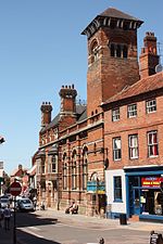
Kirk Gate, Newark and Sherwood Newark
Geographical coordinates (GPS) Address Nearby Places Show on map
Geographical coordinates (GPS)
| Latitude | Longitude |
|---|---|
| N 53.077222222222 ° | E -0.80888888888889 ° |
Address
Turkish Delight
Kirk Gate 45
NG24 1AD Newark and Sherwood, Newark
England, United Kingdom
Open on Google Maps


