Charlwood
Civil parishes in SurreyCricket in SurreyEnglish cricket venues in the 18th centuryMole ValleyVague or ambiguous time from June 2020 ... and 1 more
Villages in Surrey

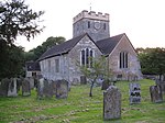
Charlwood is a village and civil parish in the Mole Valley district of Surrey, England. It is immediately northwest of London Gatwick Airport in West Sussex, close west of Horley and north of Crawley. The historic county boundary between Surrey and Sussex ran to the south of Gatwick Airport. Boundaries were reformed in 1974 so that the county boundary between Surrey and West Sussex, delineated by the Sussex Border Path, now runs along the northern perimeter of the airport, and the southern extent of Charlwood.
Excerpt from the Wikipedia article Charlwood (License: CC BY-SA 3.0, Authors, Images).Charlwood
Rosemary Lane, Mole Valley Charlwood
Geographical coordinates (GPS) Address Nearby Places Show on map
Geographical coordinates (GPS)
| Latitude | Longitude |
|---|---|
| N 51.156 ° | E -0.223 ° |
Address
Rosemary Lane
Rosemary Lane
RH6 0DG Mole Valley, Charlwood
England, United Kingdom
Open on Google Maps


