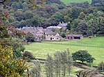
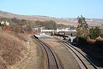
Hayfield, Derbyshire
Civil parishes in DerbyshireEngvarB from May 2015High Peak, DerbyshireTowns and villages of the Peak DistrictVillages in Derbyshire

Hayfield (SK037870) is a village and civil parish in High Peak, Derbyshire, England, with a population of around 2,700. The village is 3 miles (4.8 km) east of New Mills, 4.5 miles (7.2 km) south of Glossop and 10 miles (16 km) north of Buxton, in the basin of the River Sett.The civil parish includes Hayfield village itself, the hamlets of Little Hayfield and part of Birch Vale, and a significant proportion of the Kinder Scout plateau.
Excerpt from the Wikipedia article Hayfield, Derbyshire (License: CC BY-SA 3.0, Authors, Images).Hayfield, Derbyshire
Snake Path, High Peak
Geographical coordinates (GPS) Address Nearby Places Show on map
Geographical coordinates (GPS)
| Latitude | Longitude |
|---|---|
| N 53.38 ° | E -1.94 ° |
Address
Snake Path
Snake Path
SK22 2LD High Peak
England, United Kingdom
Open on Google Maps


