place

Shepherd's Close

Wildlife Trust for Bedfordshire, Cambridgeshire and Northamptonshire reserves
Shepherd's Close 8
Shepherd's Close 8

Shepherd's Close is a 1.2-hectare (3.0-acre) nature reserve south of Spaldwick in Cambridgeshire. It is managed by the Wildlife Trust for Bedfordshire, Cambridgeshire and Northamptonshire.This small wood was planted in 1984 with ash, field maple and oak. Birds include blackcaps and chiffchaffs, and there are peacock, orange-tip and speckled wood butterflies.There is access from Stonely Road.

Excerpt from the Wikipedia article Shepherd's Close (License: CC BY-SA 3.0, Authors, Images).

Shepherd's Close
Easton Road, Huntingdonshire Easton

Geographical coordinates (GPS) Address Website External links Nearby Places
placeShow on map

Wikipedia: Shepherd's CloseContinue reading on Wikipedia

Geographical coordinates (GPS)

Latitude Longitude
N 52.323 ° E -0.339 °
placeShow on map

Address

Shepherds Close

Easton Road
PE28 0TS Huntingdonshire, Easton
England, United Kingdom
mapOpen on Google Maps

Website
wildlifebcn.org

linkVisit website

linkWikiData (Q7494453)
linkOpenStreetMap (777329056)

Shepherd's Close 8
Shepherd's Close 8
Share experience

Nearby Places

Stow Longa

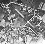
Stow Longa is a village and civil parish in Cambridgeshire, England. Stow Longa lies approximately 8 miles (13 km) west of Huntingdon and two miles north of Kimbolton. Stow Longa is situated within Huntingdonshire which is a non-metropolitan district of Cambridgeshire as well as being a historic county of England. Stow Longa's original name was Stow or Long Stow, which comes from the Old English word stōw (meaning 'holy place') and the Latin word longa or Old English lang (meaning 'long'). Altogether, Stow Longa's name may mean 'the long holy place' or 'an extended settlement which is a holy place', though this is only a rough guess. Stow was also thought to have been the name of the pre-Conquest estate, which, in the medieval period, was split between two parishes: one, Over Stow or Upper Stow, the western part, which belonged to the Kimbolton parish, and the other, Estou (also Nether Stow or Long Stow), the eastern part, which was part of the soke of Spaldwick. Mistakenly described as a hamlet, it has the suitable number of houses and businesses to make it a village. Stow Longa is a village that is still void of any street lamps, village shops, a school or a public house. Sewer drainage came to the village in 2009. However, Stow Longa does possess several thatched cottages, a village room, a blocked-up well (on the village green), a stone cross (discussed below) and mature elm trees that survived the Dutch elm disease crisis. RAF Kimbolton was opened as a bomber airfield on the southern edge of the village in 1941, and was operated by the USAAF from 1942 to 1945. According to a locally published collection of short stories, 'Ploughing Songs' by Damian Croft, the reason why the public houses that were in Stow Longa were closed down in the 1950s was because, "returning drovers used it to give a bad name to a few otherwise nameless women."

Grafham Water
Grafham Water

Grafham Water is an 806.3-hectare (1,992-acre) biological Site of Special Scientific Interest (SSSI) north of Perry, Huntingdonshire. It was designated an SSSI in 1986. It is a reservoir with a circumference of about 16 km (10 mi), is 21 m (69 ft) deep at maximum, and is the eighth largest reservoir in England by volume and the third largest by area at 6.27 km2 (1,550 acres). An area of 114 ha (280 acres) at the western end is a nature reserve managed by the Wildlife Trust for Bedfordshire, Cambridgeshire and Northamptonshire.The lake was created by building an earth and concrete dam, constructed by W. & C. French in 1965, and water is extracted and processed at an adjacent Anglian Water treatment plant before being piped away as drinking water. It was shown from the air, before it opened, in 'Look at Life (film series)' ' 1965 episode, 'Will Taps Run Dry ?', narrated by Tim Turner. The reservoir was immediately colonised by wildlife and a nature reserve was created at the western side of the reservoir. The nature reserve contains semi-natural ancient (at least 400 years old) woodlands and more recent plantation woodlands, grasslands and wetland habitats such as reedbeds, willow and open water. The reservoir has nationally important numbers of wintering great crested grebes, tufted ducks and coots, and of moulting mute swans in late summer. A pond has a population of the nationally uncommon warty newt.Water is obtained by pumping water from the River Great Ouse nearby. There are two pumping stations associated with the reservoir. One is located just behind the dam, the other at Offord Cluny alongside the River Great Ouse. At times of high potential flood risk, Grafham Water treatment works can increase the amount of water it takes up to maximum capacity to help reduce the risk of flooding along the river. As of January 2011, it was the only site in England, and the first in the UK, to harbour the invasive killer shrimp (Dikerogammarus villosus).Grafham Water is popular for a range of leisure activities including sailing, fly fishing and cycling. In 2019, a live-action gaming centre, Rumble Live Action Gaming, was opened in the woodland arenas on the edge of the reservoir.