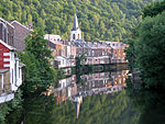
Fléron
FléronLiège geography stubsMunicipalities of Liège Province

Fléron (French pronunciation: [fleʁɔ̃] (listen); Walloon: Fléron) is a municipality of Wallonia located in the province of Liège, Belgium. On January 1, 2006, Fléron had a total population of 16,088. The total area is 13.72 km2 (5 sq mi) which gives a population density of 1,172 inhabitants per km². Fléron is east of the city of Liège. The municipality consists of the following districts: Fléron, Magnée, Retinne, and Romsée. The reminders of Fort de Fléron are in the center of the village of Fléron.
Excerpt from the Wikipedia article Fléron (License: CC BY-SA 3.0, Authors, Images).Fléron
Rue Jean-Hubert Tillmans,
Geographical coordinates (GPS) Address Nearby Places Show on map
Geographical coordinates (GPS)
| Latitude | Longitude |
|---|---|
| N 50.616666666667 ° | E 5.6833333333333 ° |
Address
Rue Jean-Hubert Tillmans
4620
Liège, Belgium
Open on Google Maps


