Battle of St. Michaels

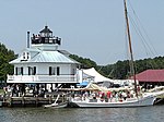
The Battle of St. Michaels was an engagement contested on August 10, 1813, during the War of 1812. British soldiers attacked the American militia at St. Michaels, Maryland, which is located on Maryland's Eastern Shore with access to Chesapeake Bay. At the time, this small town was on the main shipping route to important cities such as Baltimore and Washington, D.C. Although St. Michaels had little importance compared to Washington and Baltimore, it was a target for the British because of its ship building and its connection with the town of Easton, which was the largest community in the Maryland Eastern Shore region. St. Michaels is located on the St. Michaels (later named Miles) River, which could be used with smaller boats to get within three miles (4.8 km) of Easton. St. Michaels was attacked early in the morning before sunrise, when British forces arrived on the shore near the town. They quickly disabled an artillery battery, and returned to their boats. As they maneuvered their flotilla closer to the town, two other batteries manned by local militia opened fire. A boom placed across the mouth of the town's harbor successfully prevented the British from getting closer. Although the British returned fire, they eventually retreated to their base at Maryland's Kent Island. The locals suffered no casualties, while the British had casualties and damage to at least one barge. According to local legend, the citizens of St. Michaels hung lanterns in trees to fool the British artillerists, causing them to overshoot most of the town's buildings.
Excerpt from the Wikipedia article Battle of St. Michaels (License: CC BY-SA 3.0, Authors, Images).Battle of St. Michaels
Mulberry Street,
Geographical coordinates (GPS) Address Nearby Places Show on map
Geographical coordinates (GPS)
| Latitude | Longitude |
|---|---|
| N 38.7842705 ° | E -76.2225617 ° |
Address
Mulberry Street 201
21663
Maryland, United States
Open on Google Maps


