place

Rochefort, Belgium

Cities in WalloniaMunicipalities of Namur (province)Pages including recorded pronunciationsPages with French IPARochefort, Belgium
Rochefort JPG00
Rochefort JPG00

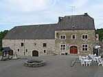
Rochefort (French pronunciation: [ʁɔʃ.fɔʁ] ; Walloon: Rotchfoirt) is a city and municipality of Wallonia located in the province of Namur, Belgium, close to the Ardennes. On 1 January 2006, Rochefort had a total population of 12,038. The total area is 165.27 km² which gives a population density of 73 inhabitants per km². It was a resort in the 19th century. The municipality consists of the following districts: Ave-et-Auffe, Buissonville, Éprave, Han-sur-Lesse, Jemelle, Lavaux-Sainte-Anne, Lessive, Mont-Gauthier, Rochefort, Villers-sur-Lesse, and Wavreille. Its ancient position at the crossroads where the route to Saint-Hubert crossed that from Liège to Bouillon required fortifying: the ruins of the old castle, which gave the place its name and a title to a long line of counts who had the right of coining their own money, still exist. This castle underwent many sieges and suffered at the hands of Marshal de Châtillon (1636). Near Rochefort are the red marble quarries of St. Remy, and Rochefort Abbey, a Trappist monastery, which operates the Rochefort Brewery, known for brewing dark and sweet beers, especially the Rochefort 10, a deep dark-brown rich and fruity beer. The town was the site of the Battle of Bure during the Second World War.

Excerpt from the Wikipedia article Rochefort, Belgium (License: CC BY-SA 3.0, Authors, Images).

Rochefort, Belgium
Rue du Thier d'Ohet, Rochefort

Geographical coordinates (GPS) Address Nearby Places
placeShow on map

Wikipedia: Rochefort, BelgiumContinue reading on Wikipedia

Geographical coordinates (GPS)

Latitude Longitude
N 50.166666666667 ° E 5.2166666666667 °
placeShow on map

Address

Rue du Thier d'Ohet

Rue du Thier d'Ohet
5580 Rochefort
Namur, Belgium
mapOpen on Google Maps

Rochefort JPG00
Rochefort JPG00
Share experience

Nearby Places

N4 road (Belgium)
N4 road (Belgium)

The N4 road in Belgium is a highway that runs from Brussels to Luxembourg. It starts as chaussée de Wavre at Porte de Namur on the Brussels inner ring and runs south east through Wavre and Namur, Marche-en-Famenne, Bastogne, Martelange and Arlon before terminating as route de Luxembourg at the Luxembourg border. On its route is crosses the Meuse and Lessive Rivers and the Belgian Ardennes. Before the development of motorways the N4 was a main artery for traffic going south east from Brussels and it was dotted with many friteries, cafes and petrol stations. From the 1960s to the end of the 1980s, it has been superseded by the completion of the A4 motorway which runs from Delta in Brussels down past Arlon where shortly after it enters Luxembourg where it becomes part of the Luxembourg by-pass system until it reaches the south of the city where it turns south continuing down to Thionville and Metz in France and onwards. By diverting the traffic away from the N4 the motorway has caused the closure of most of these traditional Belgian friteries. Outside of major towns the N4 mostly consists of dual carriageway with the opposing lanes separated by a central reservation or concrete blocks, but certain sections are still without any form of physical separation and have been the scene of many fatal accidents. The N4 still offers a more pleasurable and scenic route to the south of Belgium for the less pressed driver and for bicyclists. The end sections remain busy routes during the rush hour due to the high number of commuters travelling to and from Brussels and Luxembourg from residential communities all over the area. Stretches of the road continue to be renovated. The N4 crosses or borders 29 municipalities in total. 4 of them in the Brussels Capital Region, 2 in Flemish Brabant, 5 in Walloon Brabant, 7 in Namur and 11 in Luxembourg. Full municipality list below, with main municipalities in bold.