Chartershaugh Bridge
Bridges across the River WearBridges completed in 1974Bridges in Tyne and WearTransport in the City of SunderlandTyne and Wear building and structure stubs ... and 2 more
United Kingdom bridge (structure) stubsUse British English from March 2017

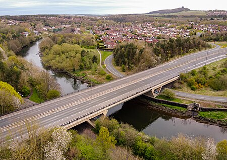
Chartershaugh Bridge is a road traffic bridge spanning the River Wear in North East England, linking Penshaw with Fatfield as part of the A182 road. The bridge was opened in 1975 and is named after the former settlement of Chartershaugh, which once stood on a site near the bridge.
Excerpt from the Wikipedia article Chartershaugh Bridge (License: CC BY-SA 3.0, Authors, Images).Chartershaugh Bridge
Chartershaugh Bridge, Sunderland
Geographical coordinates (GPS) Address External links Nearby Places Show on map
Geographical coordinates (GPS)
| Latitude | Longitude |
|---|---|
| N 54.876 ° | E -1.5195 ° |
Address
Chartershaugh Bridge
Chartershaugh Bridge
NE38 8AN Sunderland
England, United Kingdom
Open on Google Maps


