place

Ottignies-Louvain-la-Neuve

Cities in WalloniaMunicipalities of Walloon BrabantOttignies-Louvain-la-Neuve
Belgique Ottignies maison communale 01

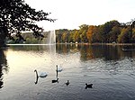
Ottignies-Louvain-la-Neuve (French pronunciation: [ɔtiɲi luvɛ̃ la nœv] (listen); Walloon: Ocgniye-Li Noû Lovén) is a city and municipality of Wallonia located in the Belgian province of Walloon Brabant. On January 1, 2006, Ottignies-Louvain-la-Neuve had a total population of 29,521. The total area is 32.96 km² which gives a population density of 896 inhabitants per km². The municipality consists of the following sub-municipalities: Ottignies, Louvain-la-Neuve, Céroux-Mousty, and Limelette. Louvain-la-Neuve (sometimes abbreviated as "LLN") is a new town developed from 1968 in order to provide a home for the University of Louvain (UCLouvain), the French-speaking part of the former Catholic University of Louvain on its separation from the Dutch-speaking part, which remained in the ancient city of Louvain (Leuven).

Excerpt from the Wikipedia article Ottignies-Louvain-la-Neuve (License: CC BY-SA 3.0, Authors, Images).

Ottignies-Louvain-la-Neuve
Grand Chemin (nᵒ 1),

Geographical coordinates (GPS) Address Nearby Places
placeShow on map

Wikipedia: Ottignies-Louvain-la-NeuveContinue reading on Wikipedia

Geographical coordinates (GPS)

Latitude Longitude
N 50.666666666667 ° E 4.5 °
placeShow on map

Address

Grand Chemin (nᵒ 1) 34
1380 (Lasne)
Walloon Brabant, Belgium
mapOpen on Google Maps

Belgique Ottignies maison communale 01
Share experience

Nearby Places

Lasne
Lasne

Lasne (French pronunciation: [lan] (listen); Walloon: Lane) is a municipality of Wallonia located in the province of Walloon Brabant, Belgium, south east of Brussels. In 2008, Lasne had a population of 14,043. The total area is 47.22 km² which gives a population density of 297 inhabitants per km². Lasne is the richest municipality in Wallonia, measured by the average taxable income of the inhabitants. It also has the lowest local taxes of any municipality in Belgium. The municipality consists of the following districts: Couture-Saint-Germain, Lasne-Chapelle-Saint-Lambert, Maransart, Ohain, and Plancenoit (including the hamlet of Marache). While the municipality has taken the name of Lasne, the administrative offices are in the village of Ohain. Ohain contains an example of a Brabant-Wallon village green: almost triangular in shape and sloping gently. The green contains many mature trees and is bordered on 2 sides by old houses and shops. The church in Ohain was built around the year 1200 and the strongly built square tower dates from this time. The village of Couture-Saint-Germain contains the ruins of the Cistercian Abbey of Aywiers which has been the subject of pilgrimages since the late 19th century in honour of Saint Lutgarde who lived there for 30 years in the first half of the 13th century. Much of the Battle of Waterloo was fought in the village of Plancenoit, notably around the church and the fortified farm of La Papelotte. The cemetery wall is said to still contain holes made by musket balls. It was in Plancenoit that Blücher's troops engaged Napoleon's army, having marched from Wavre. Blücher and Wellington met after the battle at the farm 'La Belle Alliance' - now a bar. The current historic area commemorating the battle is jointly administered by the municipalities of Lasne, Waterloo and Braine-l'Alleud.